Bedford Air Force Station
|
Bedford Air Force Station (1956-1975) - A Cold War Air Force Radar Station first established in 1956 near Bedford, Bedford County, Virginia. Named Bedford Air Force Station after the location. Initially assigned a Permanent ID of M-121, later a Sage ID of Z-121. Deactivated by the Air Force in 1975 and part assumed by the FAA as Bedford FAA Radar Site with an FAA ID of QBE.
HistoryEstablished late in 1954 and became operational in 1956 as Bedford Air Force Station manned by the 649th AC&W Squadron. The Air Force Station straddled the line between Bedford County and Botetourt County on Apple Orchard Mountain near the Blue Ridge Parkway in Virginia. The station initially had both a Ground-Control Intercept (GCI) and early warning mission. The early warning mission involved tracking and identifying all aircraft entering their airspace while the GCI mission involved guiding Air Force interceptors to any identified enemy aircraft. Controllers at the station vectored fighter aircraft at the correct course and speed to intercept enemy aircraft using voice commands via ground-to-air radio. Initial equipment included the MPS-11 search radar and an MPS-8 height-finder radar. SAGE System TransitionThe transition of the manual GCI system to the automated SAGE system began with the installation of the FST-2 coordinate data transmitter and search radar upgrades. The FST-2 equipment digitized the radar returns and transmitted the digital returns to the SAGE direction center. Under the SAGE System, interceptor aircraft were directed to their targets by the direction center computers and controllers, greatly reducing the need for local controllers and equipment at every radar station. The FST-2 was a very large digital system using vacuum tube technology. Over 6900 vacuum tubes were used in each FST-2 requiring 21 air-conditioned cabinets, 40 tons of air conditioning, 43.5 kva of prime power, and usually a large new addition to the operations building. The FST-2B modification added two more cabinets but with newer solid-state (transistor) technology to process coded responses from aircraft transponders. SAGE System Operation
The site began operation as a SAGE site in 1959 initially feeding the Fort Lee SAGE Direction Center DC-04. By 1958 the search radar was upgraded to an FPS-20A and two FPS-6 height-finder radars had been added in preparation for SAGE System operation. On 21 Dec 1959, the site began joint use operation performing air traffic control duties for the FAA. The FPS-20A was later upgraded to an FPS-67B in 1963. One FPS-6 height-finder was removed in 1968. The FAA assumed maintenance responsibility for the FPS-67B while the Air Force maintained the remaining height-finder. Air Force Station ClosureBedford AFS and the 649th were deactivated on 30 June 1975 and parts of the site were transferred to the FAA. Bedford FAA Radar Site This site probably became an operational FAA radar site on the closure of Bedford Air Force Station using the existing Air Force gear which included the FPS-67B search radar, at least one FPS-90 height-finder, and an FYQ-47 Common Digitizer. The site furnishing radar track data to the FAA ARTCC's and to USAF Direction Centers. The initial FPS-67B was replaced with an FAA ARSR-3 search radar that was commissioned on 1 Jul 1980. That search radar remained in operation until it was modified to become a Common Air Route Surveillance Radar (CARSR) sometime between 1996-1999.
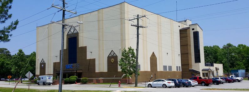
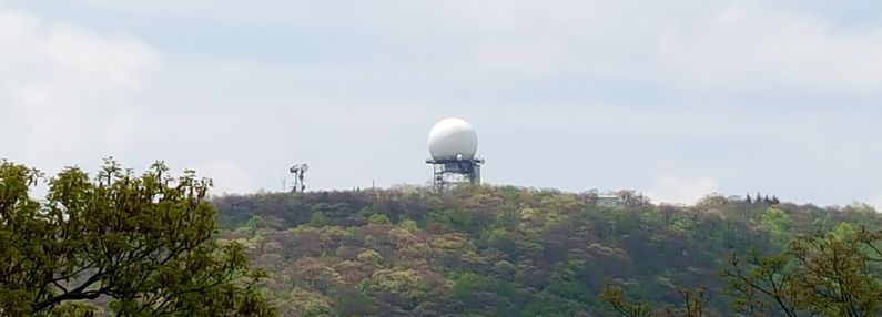
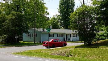
CARSR RadarThe nationwide replacement program converting FAA legacy radar systems to the CARSR radar configuration was completed by 17 Aug 2015 and Bedford FAA Radar Site was a part of that program. Legacy FAA radars underwent a Service Life Extension Program (SLEP) that replaced key components in the vintage ARSR-1, ARSR-2, FPS-20, FPS-66 and FPS-67 radars. The CARSR program replaced legacy klystron radar transmitters with a solid-state transmitter as well as renovating the radar receiver and signal processor. The CARSR modification also included common digitizer functionality making a separate common digitizer unnecessary. The Bedford FAA Radar Site is now operating with the CARSR radar. The radar site data is now available to the USAF/NORAD Battle Control System-Fixed (BCS-F) operations centers (EADS & WADS) as well as the FAA Washington DC ARTCC (ZDC) and adjacent ARTCCs. Other federal agencies have access to the data under the Homeland Security umbrella. Physical PlantThe physical plant of the Air Force Station was divided into the main site, a cantonment area, a housing area, and two radio sites. The main site housed the operations buildings, the radar towers, and the backup generators. The cantonment area housed the enlisted barracks, the bachelor officer's quarters, the orderly room, the dining hall, the motor pool, and other support buildings. Separate Ground to Air Transmitter/Receiver (GATR) radio sites housed the radio equipment for directing aircraft intercepts. The Receiver Site was located on nearby Thunder Hill while the Transmitter Site was located adjacent to the main radar site. Apart from the main site, near the town of Bedford, was Falcon Terrace, a small 27 unit housing area for married personnel. The housing area was at about 1,000' and was 16.4 miles from the cantonment area which was at about 4,000'. Personnel navigated the sometimes hazardous route daily in POVs and USAF shuttle buses. Trucks were not allowed on the Blue Ridge Parkway so a separate truck route to the site was constructed. With the closure of the Air Force Station and transition of the site to FAA operation, the old USAF cantonment area was abandoned and leveled. The operations area was reduced to a small compound surrounding the search radar and a few FAA buildings. The USAF housing area was placed in private ownership.
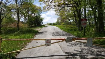
Current StatusThe main site is now the Bedford FAA Radar Site operating the minimally attended Common Air Route Surveillance Radar (CARSR) system (ARSR-3 & 9200S Antenna). The old Air Force cantonment area has been leveled. The houses in the housing area are now in private hands. Access to the upper sites from the Blue Ridge Parkway is blocked by a locked gate and a ban on parking at the entrance. Access to the main site via the Appalachian Trail can be accomplished by parking at the nearest trail access point and hiking up to Apple Orchard Mountain. The trail passes right by the FAA radar site.
See Also:
Sources:
Visited: 28 May 2016
| |||||||||||||||||||||||||||||||||||||||||||||||||||||||||||||||||||||||||||||||

