Eufaula Air Force Station
|
Eufaula Air Force Station (1958-1968) - A Cold War Air Force Radar Station first established in 1958 near Eufaula, Barbour County, Alabama. Named Eufaula Air Force Station after the location. Initially assigned a Permanent ID of TM-199, later a Sage ID of Z-199. Abandoned in 1968. HistoryEstablished in 1958 and became operational in early 1959 as Eufaula Air Force Station manned by the 609th AC&W Squadron. The station initially had both a Ground-Control Intercept (GCI) and early warning mission. The early warning mission involved tracking and identifying all aircraft entering their airspace while the GCI mission involved guiding Air Force interceptors to any identified enemy aircraft. Controllers at the station vectored fighter aircraft at the correct course and speed to intercept enemy aircraft using voice commands via ground-to-air radio. Initial equipment included the prototype FPS-24 search radar and the prototype FPS-26A height-finder radar along with a standard FPS-90 height-finder. SAGE System TransitionThe transition of the manual GCI system to the automated SAGE system began with the installation of the FST-2 coordinate data transmitter and search radar upgrades. The FST-2 equipment digitized the radar returns and transmitted the digital returns to the SAGE direction center. Under the SAGE System, interceptor aircraft were directed to their targets by the direction center computers and controllers, greatly reducing the need for local controllers and equipment at every radar station. The FST-2 was a very large digital system using vacuum tube technology. Over 6900 vacuum tubes were used in each FST-2 requiring 21 air-conditioned cabinets, 40 tons of air conditioning, 43.5 kva of prime power, and usually a large new addition to the operations building. The FST-2B modification added two more cabinets but with newer solid-state (transistor) technology to process coded responses from aircraft transponders. SAGE System Operation
The site began operation as a SAGE site in 1959 initially feeding the Gunter SAGE Direction Center DC-09. On 1 Oct 1959, the squadron designation was changed from the 609th AC&W Squadron to 609th Radar Squadron (SAGE) indicating the new SAGE System role. Gap FillersEufaula AFS was responsible for the maintenance of two remote unattended gap-filler radar sites. The unattended gap filler sites were placed in locations where the main search radar lacked coverage. These sites were equipped with short range FPS-14 or FPS-18 search radars and FST-1 Coordinate Data transmitters that sent digitized radar target data to a SAGE direction center and to the main radar site. Both the radar set and the FST-1 were dual channel to increase site up time. Maintenance teams were dispatched for regularly scheduled maintenance or when fault indicators on the FSW-1 remote monitoring equipment suggested the site had problems. The FSW-1 also allowed remote operation of specific functions such as channel changes for the radar and for the FST-1, it also allowed remote operation of the diesel generators at the gap filler site. The Eufaula AFS gap-filler radars were located at Davenport, Alabama and Bridgeboro, Georgia.
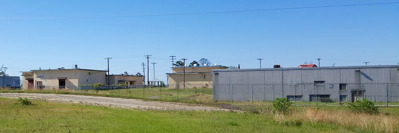
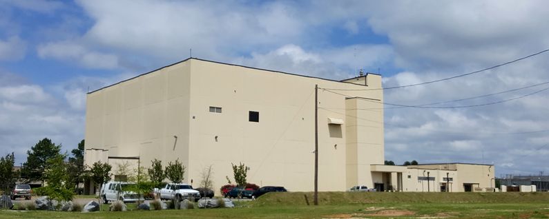
ClosureEufaula AFS and the 609th Radar Squadron were deactivated on 8 September 1968 and the Air Force Station was closed on 30 Sep 1968. The closure was the result of a catastrophic failure of the large main bearing on the AN/FPS-24 search radar set that not only damaged the radar antenna but also twisted steel tower that held it. Physical PlantThe physical plant of the site was divided into the main site, a cantonment area, a housing area and a radio site. The main site housed the operations buildings, the radar towers, and the backup generators. The cantonment area housed the enlisted barracks, the bachelor officer's quarters, the orderly room, the dining hall, the motor pool and other support buildings. Apart from the main site was a small housing area for critical married personnel. A separate Ground to Air Transmitter/Receiver (GATR) radio site housed the radio equipment for directing aircraft intercepts.
Current StatusEufaula, Barbour County, Alabama.
See Also:
Sources:
Visited: 17 Apr 2016
| |||||||||||||||||||||||||||||||||||||||||||||||||||||||||||||||||||||||||||||||

