File:Battles of New Madrid and Island Number 10.png
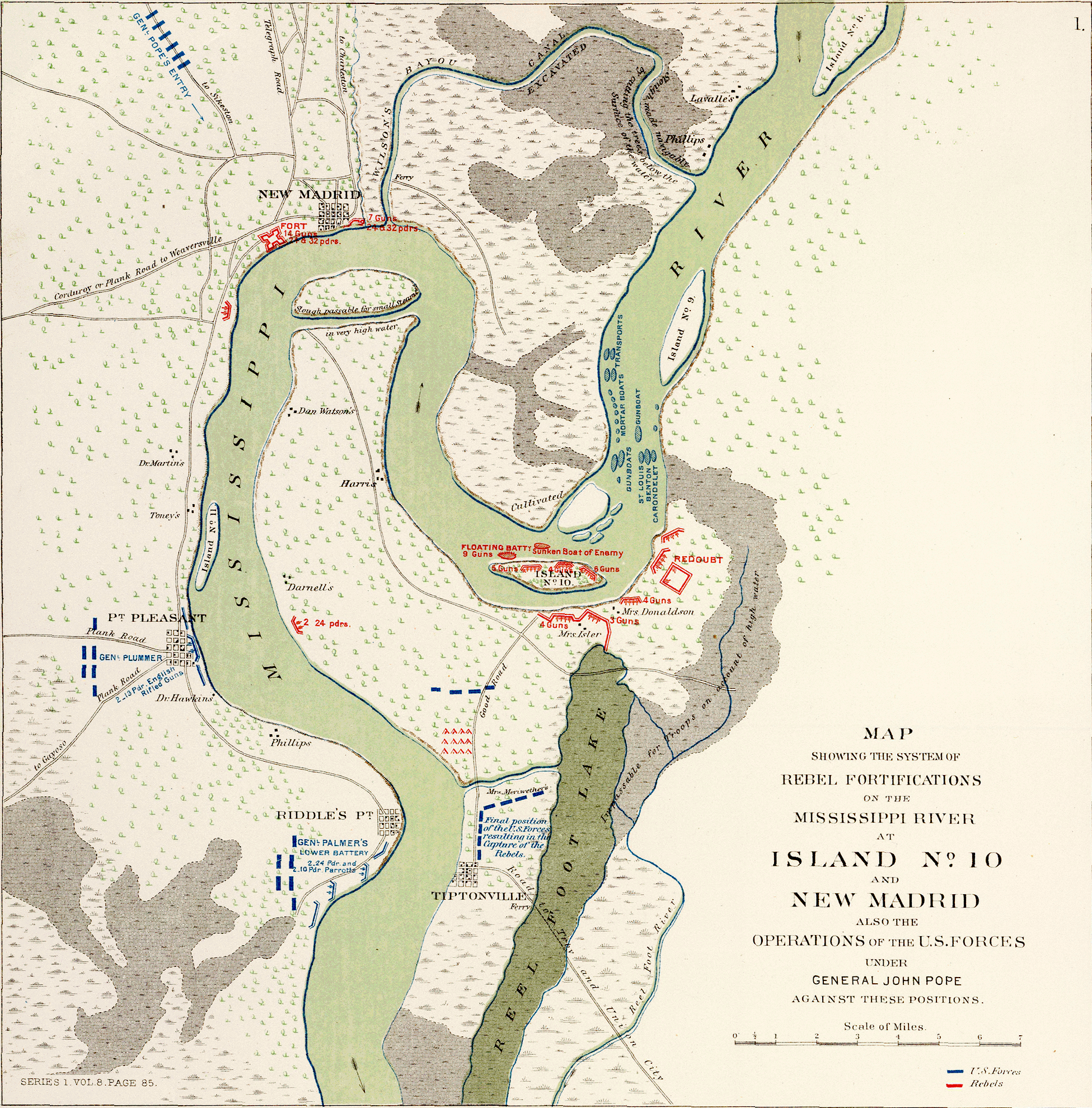
Map of Island No. 10 and New Madrid Fortifications, public domain LOC
Map showing the system of rebel fortifications on the Mississippi River at Island No. 10 and New Madrid, also the operations of the U.S. forces under General John Pope against these positions. (with) Route from Keetsville to Fayetteville, Ark. Date 1895 Source Atlas to accompany official records of the Union and Confederate armies. Published under the direction of the Hons. Redfield Proctor, Stephen B. Elkins and Daniel S. Lamont, secretaries of war, by Maj. George B. Davis, U.S. Army, Mr. Leslie J. Perry, civilian expert, Mr. Joseph W. Kirkley, civilian expert, Board of Publication. Compiled by Capt. Calvin D. Cowles, 23d U.S. Infantry. Washington: Government Printing Office, 1891-1895. Author United States War Department This map is available from the United States Library of Congress's Geography & Map Division under the digital ID g4042m.cw0300000.
File history
Click on a date/time to view the file as it appeared at that time.
| Date/Time | Thumbnail | Dimensions | User | Comment | |
|---|---|---|---|---|---|
| current | 20:50, 13 September 2020 | | 1,951 × 1,980 (5.57 MB) | John Stanton (Talk | contribs) | Map of Island No. 10 and New Madrid Fortifications, public domain LOC Map showing the system of rebel fortifications on the Mississippi River at Island No. 10 and New Madrid, also the operations of the U.S. forces under General John Pope against these... |
- Edit this file using an external application (See the setup instructions for more information)
File usage
The following 2 pages link to this file: