File:Fort Hunter 3 Map.jpg
From FortWiki
Size of this preview: 515 × 600 pixels.
Full resolution (2,000 × 2,330 pixels, file size: 837 KB, MIME type: image/jpeg)
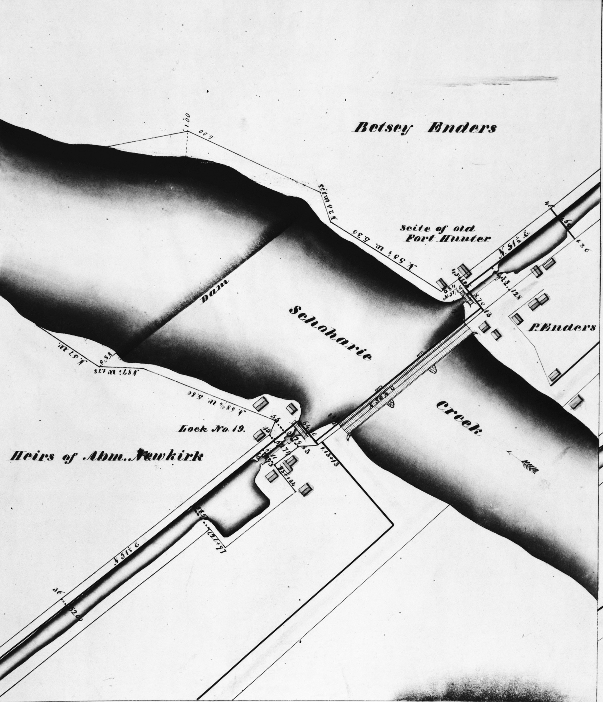
Fort Hunter Map Showing Erie Canal Route and the Location of Old Fort Hunter, public domain This image is available from the United States Library of Congress, Prints and Photographs Division under the digital ID 117503pu. No known copyright restrictions.
File history
Click on a date/time to view the file as it appeared at that time.
| Date/Time | Thumbnail | Dimensions | User | Comment | |
|---|---|---|---|---|---|
| current | 04:24, 19 December 2015 | | 2,000 × 2,330 (837 KB) | John Stanton (Talk | contribs) | Fort Hunter Map Showing Erie Canal Route and the Location of Old Fort Hunter, public domain {{LOC|DigitalID=117503pu}} |
- Edit this file using an external application (See the setup instructions for more information)
File usage
The following page links to this file: