File:Milagra Ridge WWII Radar Coverage.jpg
From FortWiki
Size of this preview: 800 × 562 pixels.
Full resolution (1,400 × 983 pixels, file size: 142 KB, MIME type: image/jpeg)
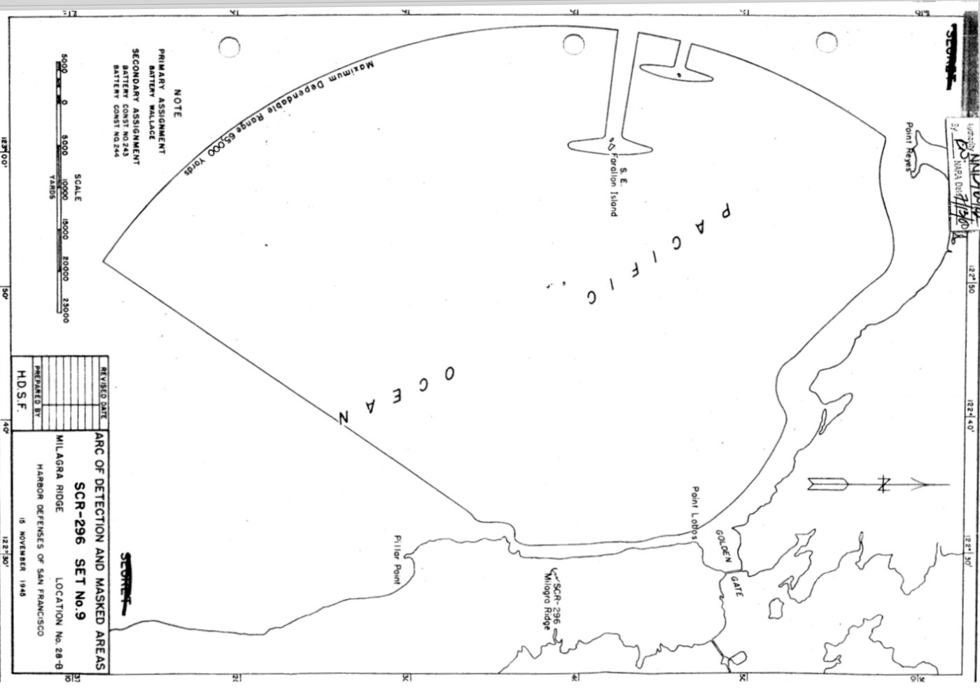
Milagra Ridge WWII Radar Coverage, public domain,
- U.S.Army, Supplement to the Harbor Defense Project Harbor Defenses of San Francisco, (CCA-P-SFB), 15 Nov 1945, CDSG, Location, Loc 28-B
File history
Click on a date/time to view the file as it appeared at that time.
| Date/Time | Thumbnail | Dimensions | User | Comment | |
|---|---|---|---|---|---|
| current | 23:46, 30 April 2019 | | 1,400 × 983 (142 KB) | John Stanton (Talk | contribs) | Milagra Ridge WWII Radar Coverage, public domain, {{HBSuppSanFranciscoWWII}}, Location, Loc 28-B |
- Edit this file using an external application (See the setup instructions for more information)
File usage
The following page links to this file: