File:Packwood Ferry Locale 1853.png
From FortWiki
Size of this preview: 800 × 572 pixels.
Full resolution (1,385 × 991 pixels, file size: 2.73 MB, MIME type: image/png)
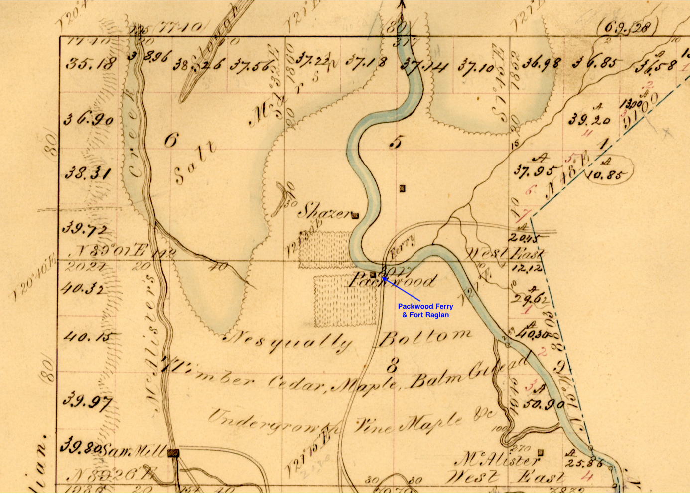
Packwood Ferry Locale from 1853 Department of the Interior Survey Map of the Nisqually River Fort Raglan Area, public domain, provided by Trent Crawford 22 May 2019
File history
Click on a date/time to view the file as it appeared at that time.
| Date/Time | Thumbnail | Dimensions | User | Comment | |
|---|---|---|---|---|---|
| current | 15:15, 23 May 2019 | | 1,385 × 991 (2.73 MB) | John Stanton (Talk | contribs) | Packwood Ferry Locale from 1853 Department of the Interior Survey Map of the Nisqually River Fort Raglan Area, public domain |
- Edit this file using an external application (See the setup instructions for more information)
File usage
The following page links to this file: