File:Port Dauphin 1.jpg
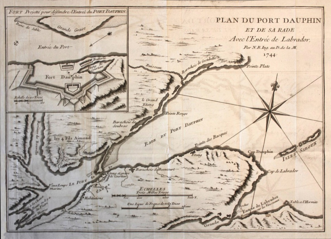
Fort Dauphin (3) (1715 to 1758) - A French military colonial fort located at present-day Englishtown, Victoria County, Nova Scotia, Canada.
BELLIN, Jacques Nicolas [1703-1772] Plan du Port Dauphin et de sa rade avec l'entrée de Labrador Date Published: 1744 Edition: 1st Edition
First edition. Copper engraved map. Image size to neat line: 11-1/4 x 7-7/8 inches Saint Anns Bay (N.S.). Port Dauphin is now Englishtown on Cape Breton island, Victoria Province, Nova Scotia. This map also has an inset view of "Fort Dauphin". The fort is "planned for defense of the harbor entry of Port Dauphin". Very detailed, showing many place names ( Pointe Rouge, Isles Siboux, Grandee entree de Labrador etc). Attractive Compass Rose. "Par N.B. Ing. au D. de la M." Visual scales. Includes inset, "Fort projetté pour défendre l'entreé du Port Dauphin.
From: Charlevoix, Pierre François Xavier de. Histoire et description general de la Nouvelle France. v. I. Paris : Chez Didor, 1744.
Jacques Nicolas Bellin (1703-1772) was one of the most important and proficient French cartographers of the mid-eighteenth century. He was appointed the first Ingenieur Hydrographe de la Marine, and also Official Hydrographer to the French King.
File history
Click on a date/time to view the file as it appeared at that time.
| Date/Time | Thumbnail | Dimensions | User | Comment | |
|---|---|---|---|---|---|
| current | 16:46, 17 December 2017 | | 1,130 × 816 (331 KB) | Ken Heaton (Talk | contribs) | Fort Dauphin (3) (1715 to 1758) - A French military colonial fort located at present-day Englishtown, Victoria County, Nova Scotia, Canada. |
- Edit this file using an external application (See the setup instructions for more information)
File usage
The following page links to this file: