File:SCR-269A Azimuth Operator Controls.png
From FortWiki
Size of this preview: 414 × 600 pixels.
Full resolution (490 × 710 pixels, file size: 129 KB, MIME type: image/png)
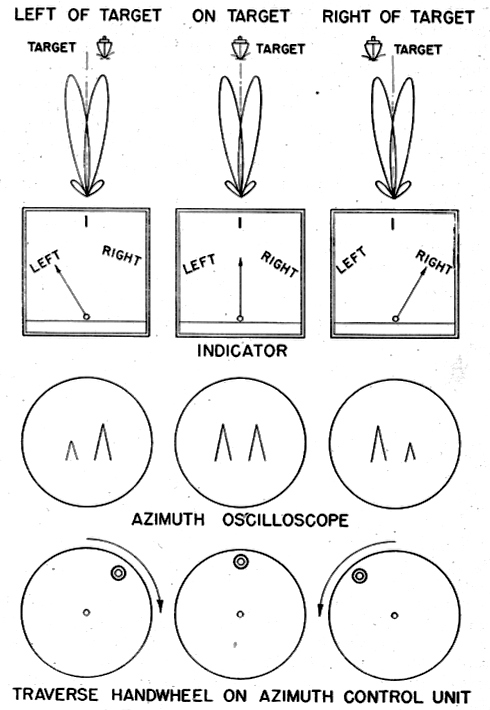
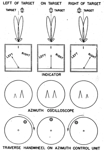
SCR-296A Azimuth Operator Displays, public domain, FM 4-95 Service of the Radio Set SCR-296A page 5
File history
Click on a date/time to view the file as it appeared at that time.
| Date/Time | Thumbnail | Dimensions | User | Comment | |
|---|---|---|---|---|---|
| current | 23:15, 23 May 2017 | | 490 × 710 (129 KB) | John Stanton (Talk | contribs) | SCR-296A Azimuth Operator Displays, public domain, FM 4-95 Service of the Radio Set SCR-296A page 5 |
- Edit this file using an external application (See the setup instructions for more information)
File usage
The following 25 pages link to this file:
- Bethany Beach WWII Radar Site (1)
- Cape May WWII Radar Site
- Devil's Slide WWII Radar Site
- Elder Point WWII Radar Site
- Fort Canby WWII Radar Site
- Fort Crockett WWII Radar Site
- Fort Ebey WWII Radar Site
- Fort Miles WWII Radar Site (2)
- Fort Moultrie WWII Radar Site (3)
- Fort San Jacinto WWII Radar Site (2)
- Fort Stevens WWII Radar Site
- Fort Travis WWII Radar Site
- Fort Worden WWII Radar Site (2)
- Gordon's Pond WWII Radar Site
- Hill 640 WWII Radar Site
- Marshall MR WWII Radar Site
- Milagra Ridge WWII Radar Site
- North Head WWII Radar Site (2)
- Rehoboth Bay WWII Radar Site
- SCR-296-A
- Salt Ponds WWII Radar Site
- Ulakata Head WWII Radar Site (2)
- Wildcat Ridge WWII Radar Site
- Template:SCR-296-AOperation
- Template:SCR-296AOperation