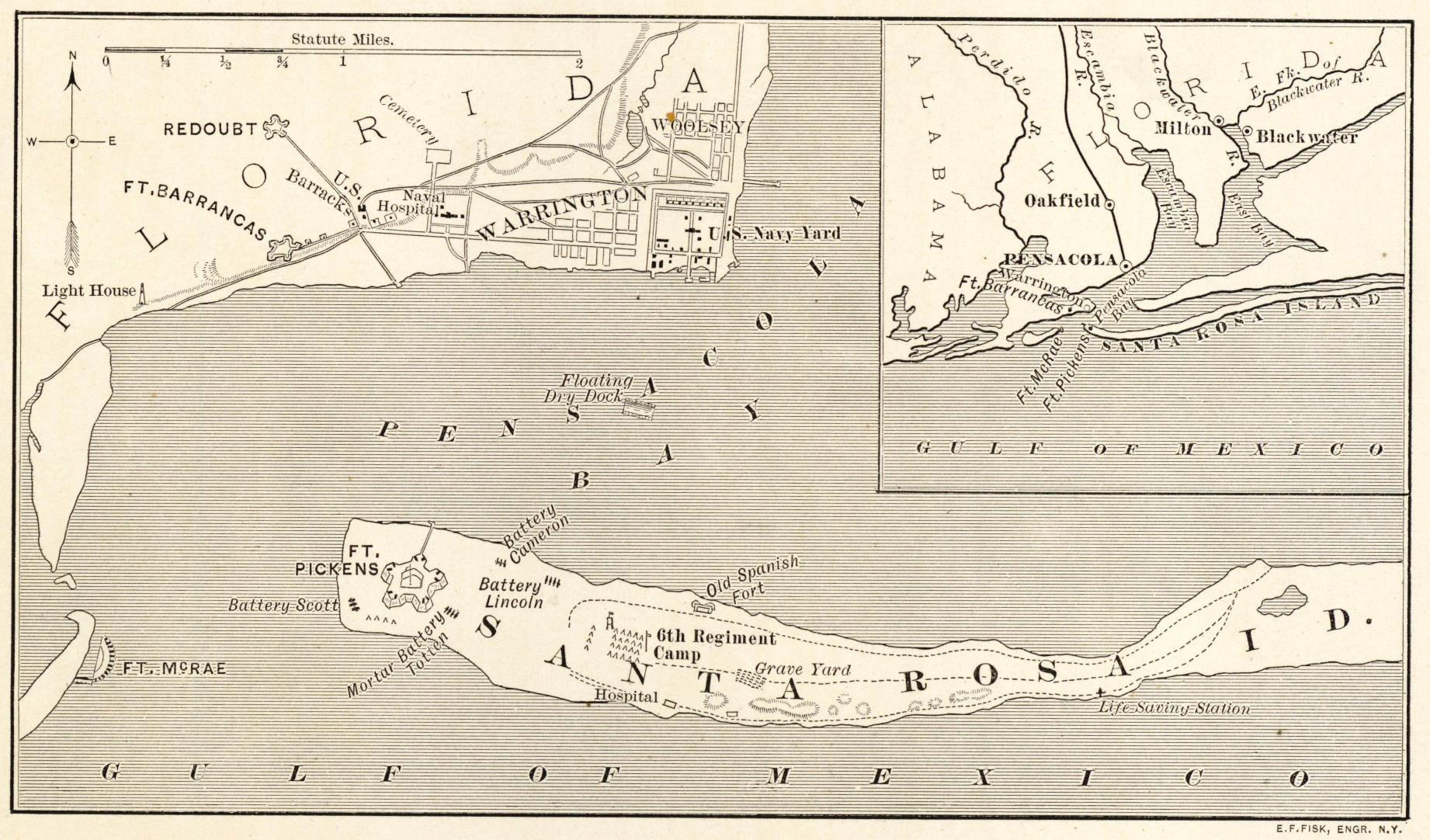
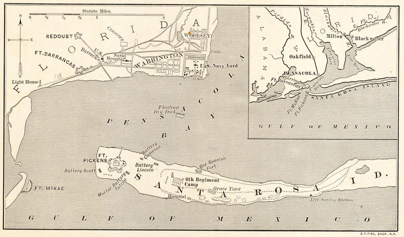
File:Santa Rosa Map 1861 (2).jpeg
From FortWiki
Size of this preview: 800 × 470 pixels.
Full resolution (1,842 × 1,082 pixels, file size: 632 KB, MIME type: image/jpeg)
Santa Rosa Island and Pensacola Area Civil War Fortifications, Energing Civil War
File history
Click on a date/time to view the file as it appeared at that time.
| Date/Time | Thumbnail | Dimensions | User | Comment | |
|---|---|---|---|---|---|
| current | 12:41, 12 October 2021 | | 1,842 × 1,082 (632 KB) | John Stanton (Talk | contribs) | Santa Rosa Island and Pensacola Area Civil War Fortifications, [https://i2.wp.com/emergingcivilwar.com/wp-content/uploads/2017/09/santa-rosa-map.jpg Energing Civil War] |
- Edit this file using an external application (See the setup instructions for more information)
.jpeg&action=edit&externaledit=true&mode=file)
File usage
The following page links to this file:
.jpeg&oldid=142446)
.jpeg)
.jpeg&action=edit&redlink=1)
.jpeg&action=edit)
.jpeg&action=history)
.jpeg)
.jpeg)
.jpeg&printable=yes)
.jpeg&oldid=142446)