Fort Casper
|
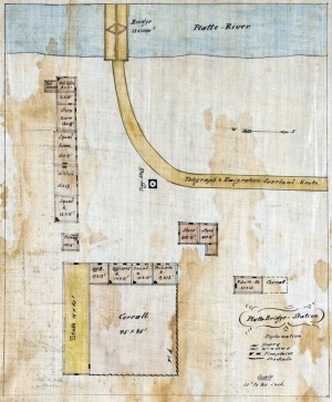
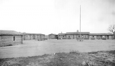
Fort Casper (1862-1867) - Originally known as Platte Bridge Station the post was renamed Fort Casper in 1865 for Lt. Caspar Collins who was killed by Indians at the Battle of Platte River Bridge 26 Jul 1865. The station was originally occupied by Company D, 6th Ohio Volunteer Cavalry starting the first week of Jun 1862. The mission of the fort was to protect the Overland Mail Company personnel and property and the Pacific Telegraph against raiding Indians. Abandoned in 1867. Also known as Fort Clay and Camp Davis (1). HistoryThe site of Fort Casper was originally occupied by Louis Guinard in 1859 when he built a trading post and a bridge across the Platte River. The trading post served as an Overland Stage Company stage stop (1859-1862), as a Pony Express relay station (1860-1861), and housed a Pacific Telegraph Company office starting in 1861. The trading post was apparently partly abandoned when Company D, 6th Ohio Volunteer Cavalry arrived in Jun 1862 and the company began the conversion to a military post. By November 1862 the post was serviceable and housed 69 enlisted men, 3 officers, and 62 serviceable horses. As the conflict with the Indians intensified troop levels and the fort grew to house 400-500 soldiers with 20 new buildings between 1865 and 1867. With the construction of the Union Pacific Railroad and a shift in the location of hostile Indians, Fort Casper became unnecessary and the order to close it came on 19 Oct 1867. Troops and all useful materials were transferred to Fort Fetterman.
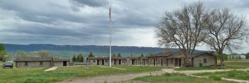
Lt. Caspar CollinsLt. Caspar Collins was killed on 26 Jul 1865 while leading a small detachment to escort an army supply train to the station. His detachment was ambushed less than a mile from the station and in the ensuing fight to get back to the station he lost control of his horse and it raced straight at the attacking Indians. Survivors told of seeing him with an arrow in his forehead, his reigns in his teeth, and a pistol in each hand charging straight at the oncoming Indians. He was later found with twenty-four arrows in his body. Major General John Pope changed the name of Platte Bridge Station to Fort Casper. General Pope chose the lieutenant's first name (and misspelled it) because there was already a Fort Collins in Colorado named for his father. Current StatusIn 1936, Casper citizens and the Works Progress Administration reconstructed Platte Bridge Station using sketches made by Caspar Collins and others in the 1860s. Each of the rooms in the reconstructed buildings has been outfitted with period fittings. Reconstructions of the Mormon ferry and a section of the Guinard bridge are also part of the site. Now a City of Casper Museum and park.
Sources:
Links: Visited: 18 Jul 2019, 1 Jun 2010 Picture Gallery
| |||||||


