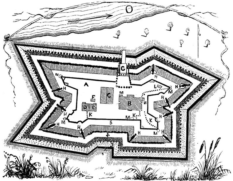
Fort Herkimer (1)
|
Fort Herkimer (1) (1740-1783) - A colonial settler fortification established in 1740 near Mohawk, Herkimer County, New York. Abandoned in 1783. Also known as Fort Kouari and Herkimer Church Fort. Fort Herkimer (1740-1756)Established in 1740 as a large stone house built by Johann Yost Herscheimer on the south bank of the Mohawk River across from present day Herkimer. The house was built of two foot thick stone and included gun loopholes on every floor and in the basement. The house was two stories high, 40' wide and 70' long. After being further fortified by Sir William Johnson the house and surrounding defenses became known as Fort Herkimer Herkimer Church Fort (1756-1783)In 1856 as the French & Indian War (1754-1763) expanded into the Mohawk River Valley and attacks by the French and their Indian allies became more ominous the fort was dismantled and moved to a new location. The new location was the site of the Herkimer Dutch Reformed Church. The church was incorporated into the new fort and the result become the Herkimer Church Fort. On the other side of the Mohawk, the British built a strong blockhouse in 1756 and named it Fort Herkimer. At the beginning of the Revolutionary War, the Herkimer Church Fort was reinforced with earthworks and a palisade. A large attack in September 1778 on the area protected by both Fort Dayton (1) and Fort Herkimer was known as German Flatts. The attack swept through the area destroying homes and crops but the settlers had been warned by scouts and had gathered in the forts. The forts proved too strong for the attackers led by Mohawk leader Joseph Brant. Some 700 people were made homeless by that one raid. The area was again raided in the fall of 1780 with similar results. General Benedict Arnold passed through in 1777 and General George Washington stopped here on his tour of the Mohawk Valley in 1783. Abandoned as a fortification in 1783 at the end of the war. The church was renovated and enlarged in 1812. The ramparts were later destroyed by the construction of the Erie Barge Canal in 1918. Current StatusUnclear.
See Also: Sources:
Links:
Visited: No
| ||||||
