Fort Hughes (2)
|
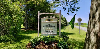
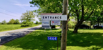
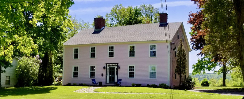
Fort Hughes (2) (1778-1782) - A Revolutionary War barracks and parade established in 1778 as Fort Hughes near Starrs Point, Nova Scotia. Named after the Governor of Nova Scotia, Sir Richard Hughes, 2nd Baronet. A large barracks on the post became known as Planters Barracks. Sold to a private owner in 1782. HistoryEarly in the American Revolutionary War, there was a great concern in Nova Scotia about raids from American privateers on coastal ports. At vulnerable points, the colonial government built forts, batteries, blockhouses, and barracks. Fort Hughes was established in response to this threat. The King's Orange Rangers under Lieutenant-Colonel John Bayard from New York were stationed at the fort during the Revolution. The Rangers were sent to the area to counter the American privateers and to ensure that the resident New England Planters remained loyal to the King. Planters BarracksThe Barracks was built on a piece of land belonging to Samuel Starr, who was a Planter from Connecticut and a colonial militia officer. The structure is a two-and-a-half story Georgian style building located at Starrs Point in Nova Scotia. The Barracks was erected just east of a militia parade ground and also served as a temporary residence for militiamen who came to train. It was built in three phases and expanded to house fifty-six men with storage, an infirmary and officers’ quarters. Abandoned as a military post and sold in 1782 to a private owner at the end of the U.S. Revolutionary War. Current StatusThe Barracks building remains and is now The Planters' Barracks Country Inn at 1464 Starr's Point Road, Starrs Point, Nova Scotia. A stone cairn commemorating the New England Planters of Cornwallis is located on the loop road around the back side of the Barracks.
See Also: Sources: Links:
Visited: 4 Jun 2018
| ||||||


