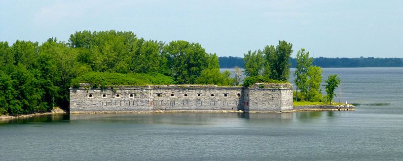
Fort Montgomery (2)
|
Fort Montgomery (2) (1844-1910) - A northern frontier fort first established in 1844 on the site of an earlier fortification on Rouses Point, Clinton County, New York. Named after General Richard Montgomery who was killed in the 1775 invasion of Canada. Abandoned in 1910. Fort Montgomery HistoryThe first fortification on this site was begun in 1816 but construction was halted when it was discovered that the construction was located on the Canadian side of the border. This first fortification was not formally named but was known as the Fort at Rouses Point and later as Fort Blunder because of the surveying error. The location problem was not resolved until the 1842 Webster-Ashburton Treaty adjusted the U.S.- Canadian border to include the fort site on the American side. Two years later construction began on the new fort and it continued until 1870. Fort Montgomery was built as a large octagonal northern frontier fort with three tiers of guns mounted inside and on top of 48 foot walls. The fort was designed to mount 148 cannons on the three tiers. The structure was surrounded by water on all sides and access to the land side was by a drawbridge over a moat. Construction was advanced enough in 1865 for the guns to be mounted but indications are that about 74 guns were actually emplaced. The post could garrison some 800 troops but never actually housed that number. This fort, like all the other northern frontier forts, was obsoleted by advances in rifled guns during the U.S. Civil War. The older armament was removed over the years until the last cannons were removed around 1909. A caretaker status was maintained until 1926 when the government sold the property at auction. The fort deteriorated, property was carried off and structures were demolished for their building materials leaving the fort today with only three bastions and two walls still upright. Current StatusPrivate property deteriorating. Viewable from the Korean War Veterans Memorial Bridge on US Route 2 as it crosses the New York - Vermont border.
Sources:
Links: Visited: 24 Jul 2012 Drive By
| ||||||
