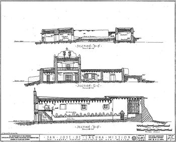
Mission San Jose de la Laguna
|
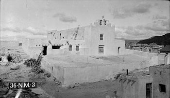
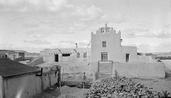
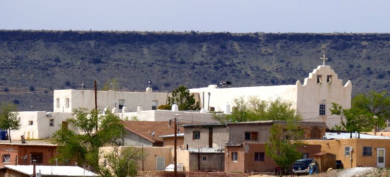
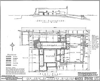
Mission San Jose de la Laguna (1699-Present) - A Spanish mission established about 1699 by Fray Antonio Miranda in present-day Laguna Pueblo, Cibola County, New Mexico. Only the Church and Convento remain today. The Spanish Period (1769-1821)Juan de Onate officially established the name New Mexico when he was appointed the first governor of the new Province in 1598. Onate extended the El Camino Real de Tierra Adentro, "Royal Road of the Interior," from Santa Barbara, Chihuahua into New Mexico opening it up for settlers and missionaries. The indigenous people of the new province were the Pueblo peoples and groups of Navajo, Apache and Utes. The villages of these people became known to the Spanish as Pueblos. The early missionaries sought to establish missions at each of the major pueblos and attempt to form the indigenous peoples into european like communities bring them into the catholic religion. The Mission San Jose de la Laguna was founded on about 1699, by Fray Antonio Miranda, as one of the twenty-one Spanish missions founded in New Mexico. On 4 Jul 1699, the people of Laguna took the oath of allegiance and obedience to Spain and received the name of San Jose de Laguna from the Spanish Governor. They then petitioned Governor Pedro Rodriguez de Cubero for a priest and he required them to build a church. They immediately built the front part of the present Convento as a residence and soon Friar Antonio de Miranda was sent and work was begun on the present church building. The church was completed by the Laguna Indians under Friar Antonio and Holy Mass was celebrated in the church before the end of 1699. The Church was reroofed and in general renovated in 1818 by Don Jose Manuel Aragon, alcalde of Acoma and Laguna. Mexican Period (1822-1846)The Mexican Revolution transitioned New Mexico from Spanish rule to Mexican Rule circa 1822. It was during the Mexican period that the role of the mission changed to a purely religious one and the mission lands were reduced to property around the church and associated cemeteries. The Mexican government instituted a secularization program for the missions that confiscated mission property and sought to remove all Spanish missionaries. Because of the Mexican Secularization Laws (1820), the Convento and other structures adjoining the Mission church could not be used by the Priest and they fell into private hands. The American Period (1846-Present)The Mexican War was declared by the U.S. Congress on 11 May 1846 in response to a Mexican attack on U.S. troops in Texas. The declaration of war opened the door for American occupation of New Mexico and U.S. forces occupied Santa Fe in August 1846. On 1 Nov 1864, President Abraham Lincoln signed land patents to various Pueblos for their holdings, and personally presented silver tipped ceremonial canes of office to the recognized Pueblo Governors at an observance in Washington, DC. These symbols of the Governors authority continued a tradition established by the Spanish and the Mexicans governments. Some of the pueblos still have all three canes while some have only the Spanish and American canes. These canes are still a symbol of office for the Governors. Lincoln's land patents resolved the ownership issues surrounding the mission lands and laid the framework for the present reservation system. In 1936 the restoration work began on the west wing of the Convento and this two-story building is the only part of the old Convento completely restored. Originally the entire Convento was two stories high. Two Sisters moved into this building in 1937. By this time the Plazita was cleared and the Monastery garden was also restored. Current StatusActive church in Laguna Pueblo, Cibola County, New Mexico.
Sources:
Visited: 17 Apr 2015
| |||||||||||
