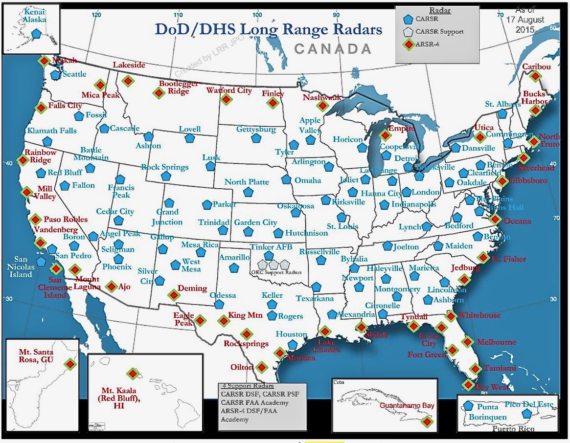
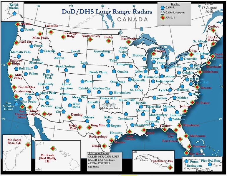
File:DoD-DHS LLR Map 2015.jpg
Size of this preview: 771 × 600 pixels. Other resolution: 1,165 × 906 pixels.
Original file (1,165 × 906 pixels, file size: 410 KB, MIME type: image/jpeg)
DoD/DHS Long Range Radar Sites a/o 17 Aug 2015 in a 3 Jan 2017 document Document, public domain Spectrum Efficient National Surveillance Radar (SENSR) Concept of Operations Version 1.0 January 3, 2017
File history
Click on a date/time to view the file as it appeared at that time.
| Date/Time | Thumbnail | Dimensions | User | Comment | |
|---|---|---|---|---|---|
| current | 08:30, 10 April 2017 | | 1,165 × 906 (410 KB) | John Stanton (talk | contribs) | DoD/DHS Long Range Radar Sites a/o 17 Aug 2015 in a 3 Jan 2017 document [https://faaco.faa.gov/index.cfm/attachment/download/73826 Document, public domain Spectrum Efficient National Surveillance Radar (SENSR) Concept of Operations Version 1.0 January ... |
You cannot overwrite this file.
File usage
The following page uses this file: