File:East Coast Radar Coverage WWII.jpg
Original file (2,848 × 2,100 pixels, file size: 564 KB, MIME type: image/jpeg)
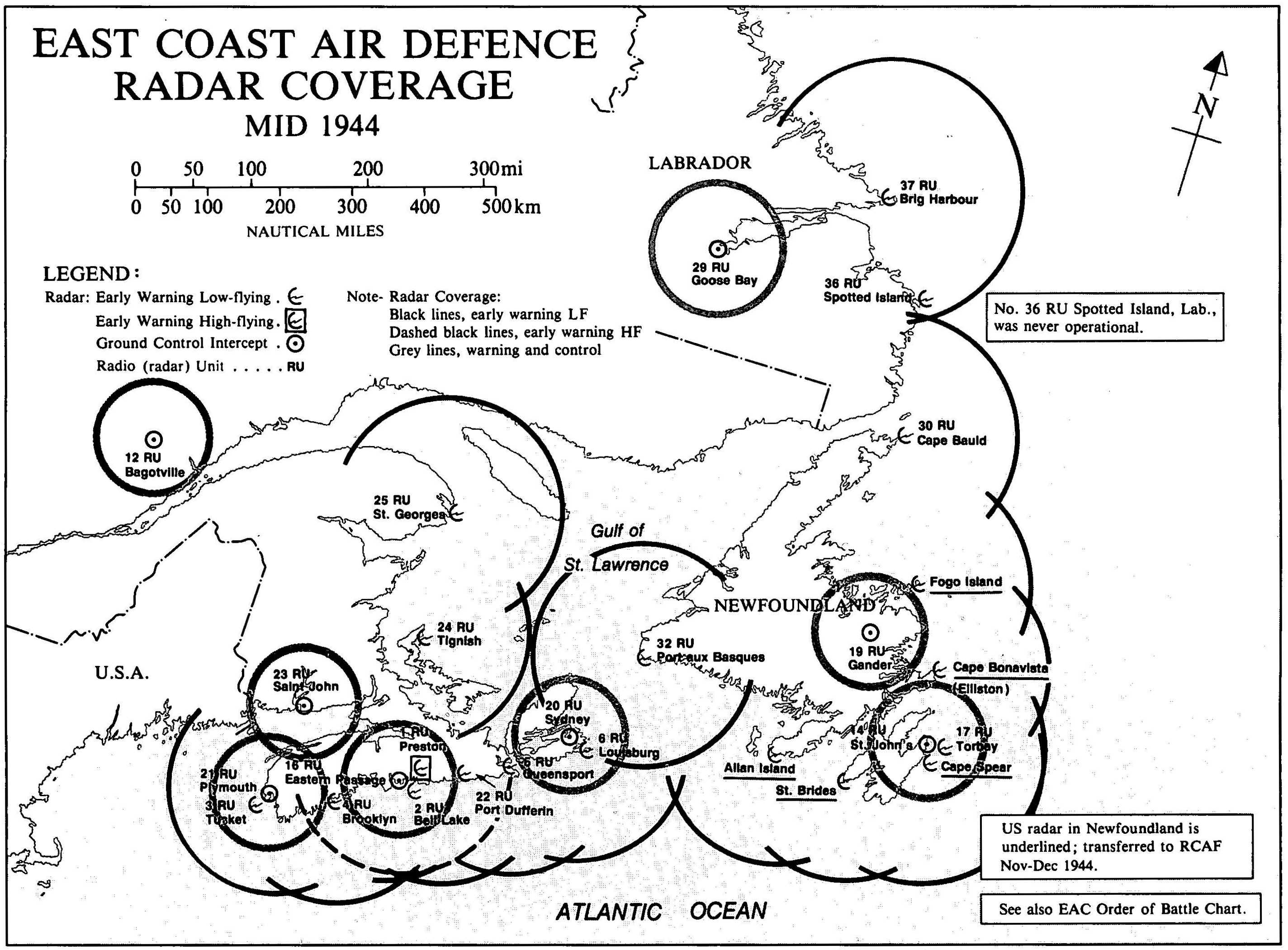
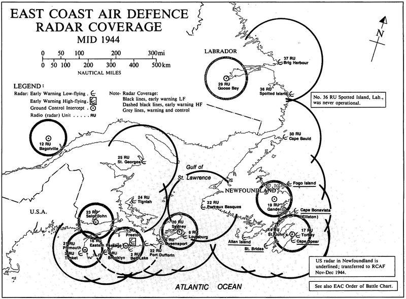
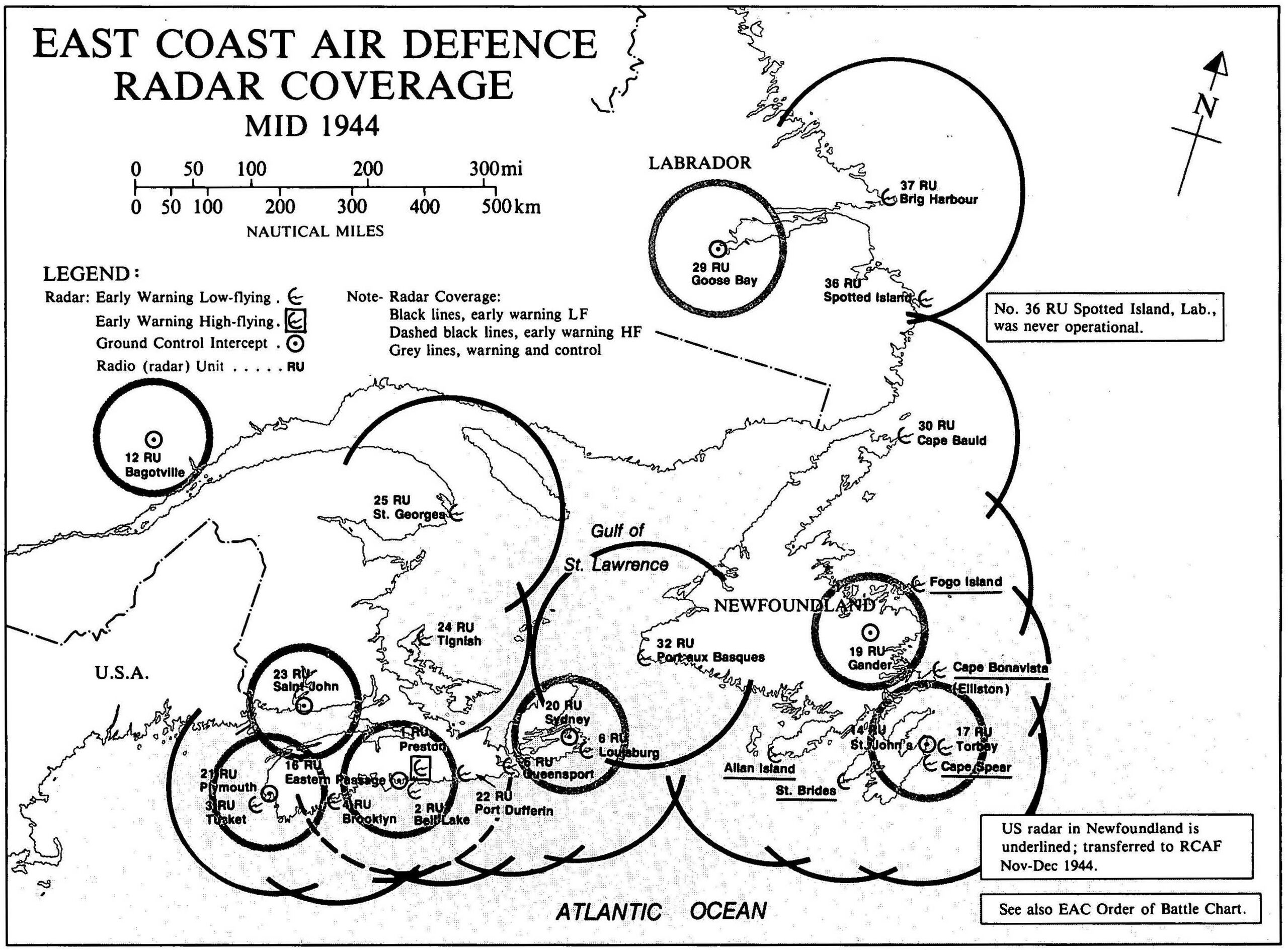
Planning for radar stations on the East Coast of Canada had started in 1940. Siting had been completed, equipment ordered and on site construction completed to enable the first stations to become active by mid 1942. The last of the stations would become operational in late 1944. The role of these stations varied depending upon the equipment at each location. They included chain home low - early warning radar (CHL), microwave early warning radar (MEW), ground controlled intercept radar (GCI) and high-fying early warning radar (TRU).
This chart was compiled and drawn by the Department of National Defence Directorate of History. It indicates the overlapping radar coverage of the area.
File history
Click on a date/time to view the file as it appeared at that time.
| Date/Time | Thumbnail | Dimensions | User | Comment | |
|---|---|---|---|---|---|
| current | 04:49, 19 December 2017 | | 2,848 × 2,100 (564 KB) | Ken Heaton (talk | contribs) | Planning for radar stations on the East Coast of Canada had started in 1940. Siting had been completed, equipment ordered and on site construction completed to enable the first stations to become active by mid 1942. The last of the stations would becom... |
You cannot overwrite this file.
File usage
The following 2 pages use this file: