File:Tyndall AFB Radar 2018 Michael.jpg
From FortWiki
No higher resolution available.
Tyndall_AFB_Radar_2018_Michael.jpg (617 × 536 pixels, file size: 102 KB, MIME type: image/jpeg)
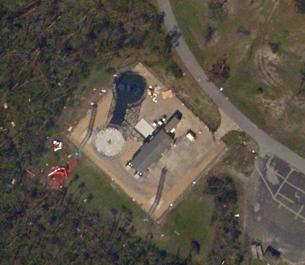
Tyndall AFB FAA Radar Site after Hurricane Michael, public domain NOAA Map
File history
Click on a date/time to view the file as it appeared at that time.
| Date/Time | Thumbnail | Dimensions | User | Comment | |
|---|---|---|---|---|---|
| current | 15:47, 15 October 2018 | | 617 × 536 (102 KB) | John Stanton (Talk | contribs) | Tyndall AFB FAA Radar Site after Hurricane Michael, public domain [https://storms.ngs.noaa.gov/storms/michael/index.html#19/30.07600/-85.61059 NOAA Map] |
- Edit this file using an external application (See the setup instructions for more information)
File usage
The following page links to this file: