Category:Fort Simcoe: Difference between revisions
No edit summary |
No edit summary |
||
| Line 16: | Line 16: | ||
'''Location:''' White Swan, Yakima Indian Reservation, Washington (30 miles west of Toppenish, Yakima County) | '''Location:''' White Swan, Yakima Indian Reservation, Washington (30 miles west of Toppenish, Yakima County) | ||
{{Mapit-US-cityscale| | {{Mapit-US-cityscale|46.34088|-120.83762}} | ||
'''Links:''' | '''Links:''' | ||
Revision as of 15:37, 7 October 2005
This is a stub article. You are encouraged to add content and remove the stub notation {{Stub}} when you feel it has enough content to qualify as a full article.


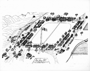
Fort Simcoe (1856-1859) - The first commander at Fort Simcoe was Robert Seldon Garnet. His regiment was part of the 9th U.S. Infantry Division.
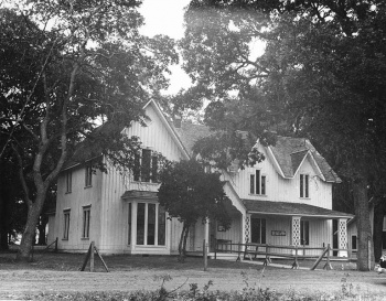
The fort was used as the Yakima Indian Agency beginning in 1859 after the garrison transferred to Fort Colville. It was abandoned in 1923. The state leased the state park property from the Yakima Nation in 1953. The fort has been restored and contains three officers quarters (1857 - 1858), one of four original blockhouses (1856), and the Commandant's House (1857 - 1858).
In 1956, Fort Simcoe became a state park, and in 1974 it was added to the National Register of Historic Places.
Location: White Swan, Yakima Indian Reservation, Washington (30 miles west of Toppenish, Yakima County)
Maps & Images
Lat: 46.34088 Long: -120.83762
Links:
Publications:
Pages in category "Fort Simcoe"
The following 2 pages are in this category, out of 2 total.