Eagle Pass Air Force Station
|
Eagle Pass Air Force Station (1957-1963) - A Cold War Air Force Radar Station first established in 1957 on the former Eagle Pass Army Air Field in Maverick County, Texas. Named Eagle Pass Air Force Station after the location. Initially assigned a Permanent ID of TM-188. Abandoned in 1963.
HistoryEstablished in 1957 and became operational in 1959 as Eagle Pass Air Force Station manned by the 733rd AC&W Squadron.  This station was one of eight stations established in the final phase of the Permanent AC&W Radar Program for the 33rd Air Division. The 33rd Air Division would remain a manual operation throughout the transition of the rest of the Air Defense System to the semi-automatic SAGE System. The Oklahoma City Manual Direction Center P-86 remained connected to these sites until they closed down one by one. Because the sites were never destined to become SAGE sites they received older less capable equipment and facilities and they were among the first to be closed when budgets constricted. The eight sites were:
The station initially had both a Ground-Control Intercept (GCI) and early warning mission. The early warning mission involved tracking and identifying all aircraft entering their airspace while the GCI mission involved guiding Air Force interceptors to any identified enemy aircraft. Controllers at the station vectored fighter aircraft at the correct course and speed to intercept enemy aircraft using voice commands via ground-to-air radio. Initial equipment included the FPS-20A search radar and an FPS-6 height-finder radar. Eagle Pass AFS operated as a manual radar site with radar track data plotted on plexiglass plotting boards and passed to the Manual Operations Center at Oklahoma City Air Force Station and adjacent radar sites.
Gap FillersEagle Pass AFS was responsible for the maintenance of two remote unattended gap-filler radar sites. The unattended gap filler sites were placed in locations where the main search radar lacked coverage. These sites were equipped with short range FPS-14 or FPS-18 search radars and FST-1 Coordinate Data transmitters that sent digitized radar target data to a SAGE direction center and to the main radar site. Both the radar set and the FST-1 were dual channel to increase site up time. Maintenance teams were dispatched for regularly scheduled maintenance or when fault indicators on the FSW-1 remote monitoring equipment suggested the site had problems. The FSW-1 also allowed remote operation of specific functions such as channel changes for the radar and for the FST-1, it also allowed remote operation of the diesel generators at the gap filler site. The Eagle Pass AFS gap-filler radars were located at Carrizo Springs and Eagle Pass, Texas.
ClosureEagle Pass AFS and the 733rd were deactivated 1 Aug 1963. Physical PlantThe radar site was located within an eight block area of the former Army Airfield. The physical plant of the site was divided into the Operations area, a Cantonment area, a Housing area and two radio sites. The Operations Area housed the operations buildings, the radar towers, and the backup generators. The Cantonment area housed the enlisted barracks, the bachelor officer's quarters, the orderly room, the dining hall, the motor pool and other support buildings. Apart from the main site was a small 27 unit Housing area for married personnel. Separate ground to air Transmitter and Receiver radio sites housed the radio equipment for directing aircraft intercepts. 
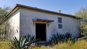
Current StatusThe site buildings mostly remain, abandoned for the most part and deteriorating. One of the barracks buildings, #250, collapsed inside itself probably the result of a fire. The FPS-20 radar tower and radome are gone but the tower foundation remains with intact mounting bolts. The FPS-6 radar tower is gone. The guard shack is also gone. Other site buildings are either empty or contain abandoned products. The Operations building and the power building contain abandoned products and trash. The recreation hall, headquarters building, motor pool, and the dining hall are empty but have some debris and graffiti in places. Many windows are broken but some remain intact. The housing area is privately owned with the houses in varying conditions.
See Also: Sources:
Visited: 29-30 Nov 2017
| |||||||||||||||||||||||||||||||||||||||||||||||||||


