Fort Cumberland (2)
|
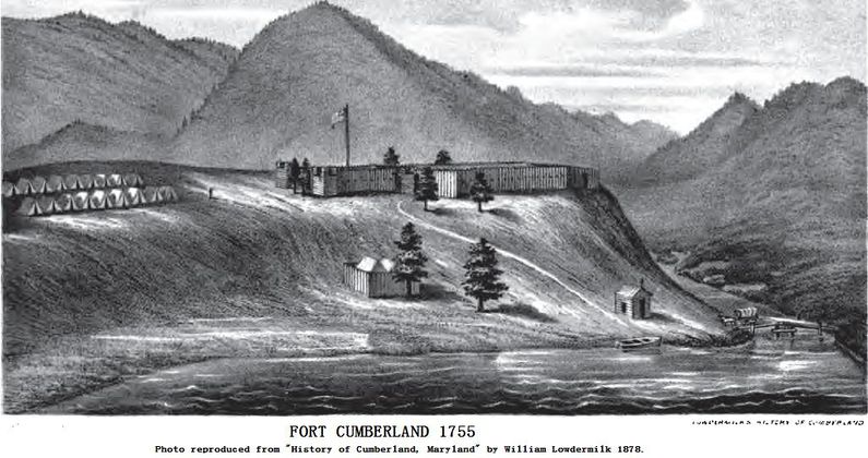
HistoryEstablished in 1754 by the Virginia colonial militia at the direction of Virginia Governor Robert Dinwiddie. The post was built in two sections, the most fortified section was built as a square log stockade with earth-filled log bastions extending from each of the four corners. One of the bastions also contained the powder magazine. The bastions mounted 12-pounder cannons, 4-pounder cannons, and swivel guns. The other fort section was also stockaded but without bastions and it contained the barracks, officer quarters and storehouses. The two sections shared a common wall and a connecting entrance. The fort served as a starting point for George Washington's first expedition against the French in 1754 and when he was forced to surrender at Fort Necessity, when released he marched his men back to Fort Cumberland. General Edward Braddock brought 1,400 British regulars to Fort Cumberland in 1755 and combined with 800 Virginia militia launched his attack on Fort Duquesne over the Braddock Road. Braddock's forces were ambushed and defeated near Fort Duquesne with horrific casualties. Braddock himself was mortally wounded and was borne from the battlefield by George Washington who organized the retreat back to Fort Necessity. Braddock died at Fort Necessity on 13 Jul 1755 and was buried in the middle of the Braddock Road near Fort Necessity. His troops marched over his grave to hide it from the enemy as they marched back to Fort Cumberland. Fort Cumberland abandoned in 1765 but was again used briefly by George Washington during the 1794 Whiskey Rebellion. Current StatusThe site now occupied by Emmanuel Episcopal Church and City Hall at the intersection of Washington and Greene streets. White markers embedded in the streets and sidewalks outline the footprint of the fort. The Episcopal Church has a model of the fort on display, sometimes open to the public on the weekends. In the basement of the church is a tunnel that led to the cliff overlooking the creek that was used as a water source.
See Also: Sources:
Links:
Visited: 31 May 2016
| ||||||
