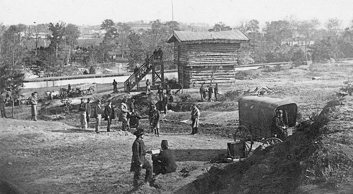
Fort Haggerty
|
Fort Haggerty (1861-1865) - A Union U.S. Civil War Fort first established in 1861 in present day Arlington County, Virginia. Named Fort Haggerty in G.O. 18, 30 Sep 1861, after Lt. Colonel James Haggerty, 69th New York Militia, who was killed at First Bull Run 21 Jul 1861. The fort was abandoned in 1865 at the end of the war.
History of Fort HaggertyFort Haggerty was also one of 33 forts on the Virginia side of the Potomac River that made up an outer defense line for Washington DC known as the Arlington Line.  Established in May 1861 as small outwork of Fort Corcoran with a perimeter of 128 yards and emplacements for 4 guns. Armament included four 24 pounder cannons. Fort Haggerty covered an area not visible from nearby Fort Corcoran. It was located to the rear of Fort Corcoran along the Chesapeake and Ohio canal route. The Potomac River Aqueduct Bridge connected the C & O Canal on the Washington side of the Potomac River with the Alexandria Canal on the Virginia side of the river. The bridge actually allowed the canal boats to cross the river and travel down the Virginia side to the Port of Alexandria. During the war the military converted the bridge and the canal into a wagon road that provided a supply road and a retreat route if necessary. Several forts guarded the approach to the bridge but Fort Haggerty and three small blockhouse were located very close to the Virginia bridgehead. A 17 May 1864 report from the Union Inspector of Artillery noted the following: "Fort Haggerty, Capt. Charles L. Smith commanding.–Garrison, one company Second New York Heavy Artillery–1 captain, 3 commissioned officers, 1 ordnance-sergeant, 164 men. Armament, four 24-pounder siege guns. Magazines, one; dry, well-packed, and serviceable. Ammunition, full supply; in a good condition. Implements, complete. Drill in artillery, fair. Drill in infantry, wants improving much. Discipline, indifferent. Garrison is more than necessary." The fort was abandoned in 1865 at the end of the war.
Current StatusNo remains, marker only at Wilson Blvd. and North Arlington Ridge Road in Arlington County, Virginia.
See Also:
Sources:
Links: Visited: No
| ||||||
