Fort Smith (2)
|
Fort Smith (1817-1834, 1839-1871) - A U.S. Army post established in 1817 by Major William Bradford, Company A, 3rd U.S. Rifle Regiment, in what is now Sebastian County, Arkansas, although as late as 1853, it was not in the State of Arkansas: Lt. Amiel Whipple (Cullum 1063), whose trek across the southwestern United States in that year started at the fort, wrote in his journal that "The western boundary of the State of Arkansas is 100 feet east of Fort Smith, between the barracks and the city which bears the same name." Named for Colonel Thomas A. Smith then Commander of U.S. forces west of the Mississippi. First abandoned in 1834 but reactivated in 1838 and finally abandoned by the U.S. Army in 1871. Also known as Belle Point Fort.
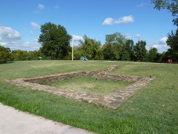
First Fort Smith (1817-1834) 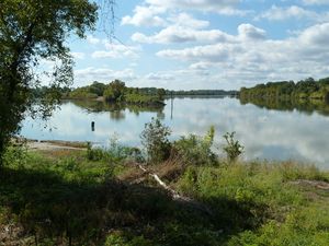 The location for the first Fort Smith was selected by topographical engineer Bvt. Major Steven H. Long on a rocky bluff above the junction of the Arkansas River and the Poteau River. This location was known as Belle Point was and was an ideal location for a fort and a strategic point along the Arkansas River. Major Long and Major William Bradford was on a mission from Arkansas Post to establish a new post far up the Arkansas River. Major Long and a party of seven men preceded the main force, selected the site and staked out the fort. The post was established 25 Dec 1817 by Major Bradford and 57 men from Company A, 3rd U.S. Rifle Regiment, as a simple 132' square log and stone stockade with two blockhouses on opposing corners. Four women were also in the main force. The new post was also known as Belle Point Fort and some of the foundations can be seen today. The garrison was small and never held more than about 130 men. The new post was not completed until 1822. The garrison was moved to Fort Gibson (1), Oklahoma in 1824. The fort was then intermittently used until 1834, with the last garrison transferring to nearby Fort Coffee, Oklahoma. The site was excavated in 1958 - 1963.
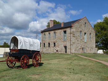
Second Fort Smith (1839-1871)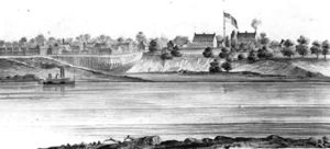 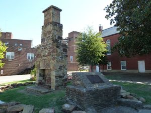 Construction on the second Fort Smith, originally planned as a large pentagonal masonry work with five bastions, began in the spring of 1839 under the supervision of Captain Charles W. Thomas. Camp Thomas, later renamed Camp Belknap (1) (1838-1846), was built adjacent to the first fort site while the second fort was being constructed. The new post was to be a massive stone fortification enclosing an area 600' by 400' with a wall 12' high and 2-3' thick. Two-story stone bastions were to be located at each of the five corners. Construction was halted in 1841 with the walls and four of the five bastions raised to the four-foot level. The fort was then reconfigured as a supply depot for other western forts and construction resumed on the post buildings. The barracks buildings were completed and occupied by troops in 1846. General Zachary Taylor served as commander of the U.S. Army Western Military District (1842-1845) and made Camp Belknap (1) his headquarters during that period. General Taylor left Fort Smith to take command of U.S. forces in Texas as the Mexican-American War began. Fort Smith served as a valuable supply post during the war. After the war, Zachary Taylor was elected President and he ordered Fort Smith deactivated. After his untimely death in 1850, the order was reversed and the post remained active until the U.S. Civil War. Fort Smith became the jumping-off point for the Gold Rush of 1849 when gold was discovered in California. Captain Randolph B. Marcy (Cullum 690) was selected to chart an efficient route to the goldfields from Fort Smith and escort the first large group. Throughout the 1850's Fort Smith served as the gateway along this route.
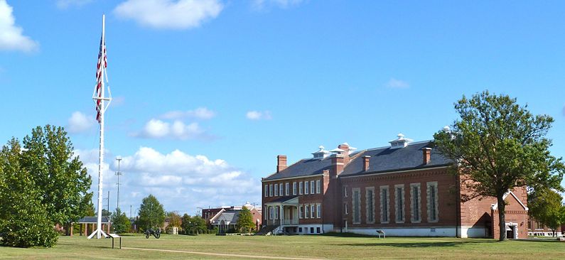
U.S. Civil War (1861-1865)As the U.S. Civil War began the War Department ordered the U.S. garrison at Fort Smith to avoid confrontation with secessionists. Captain Samuel D. Sturgis (Cullum 1303) evacuated Fort Smith on 23 Apr 1861 as secessionist militia forces approached. On 24 Apr 1861, the secessionist militia forces arrived and occupied Fort Smith even though Arkansas had not yet formally seceded. The post remained in Confederate hands until 3 Sep 1863 when Union troops re-occupied the fort. Abandoned by the U.S. Army in 1871. Federal Court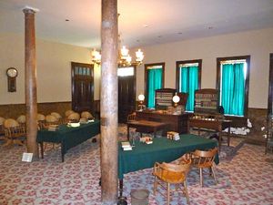 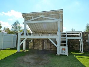 The Barracks (1849) then served as the US District Court from 1872 to 1890. The district had federal jurisdiction over half of the state of Arkansas and all of the Indian Territory. After the closure of Fort Smith in 1871, the federal court was relocated to Fort Smith. During the summer of 1872, the jail was moved into the old barracks building inside the second fort. That fall, court operations were moved into the upper floor of the barracks. For twenty-five years, Fort Smith served as a base of operations for the federal court. In 1875, Isaac Parker, the former congressman from Missouri was appointed to the bench at Fort Smith. For twenty-one years Judge Parker served as Judge, later earning the nickname of "Hanging Judge" for the number of death sentences he handed down. The jurisdiction of the federal court over the Indian Territory came to an end on 1 Sep 1896 with the coming of federal courts in the Indian Territory. Judge Parker died two months later.
Current Status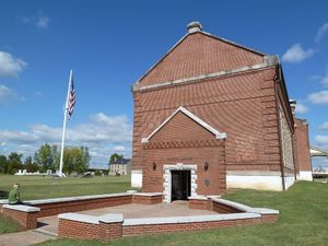 Part of Fort Smith National Historic Site. The National Park Service operates the park and the Visitor Center. Inside the visitor center is a museum that interprets the fort years and the federal Court years. Both the first fort and the second fort are interpreted. The first fort site has only foundations remaining while the second fort site has the commissary building restored and the barracks/courtroom building restored along with a reconstructed gallows from the court period. The parade has a 100' period flagpole flying a 36' by 20' garrison flag with 37 stars. The second fort walls are outlined in stone so the size of the fort can be appreciated.
Sources:
Links: Visited: 23 Oct 2011
| ||||||
