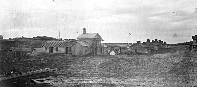
Fort Sumner (3)
|
Fort Sumner (3) (1861-1865) - First established as three independent earthworks forts in 1861 during the U.S. Civil War in Montgomery County, Maryland. Fort Ripley (3), Fort Alexander (2) and Fort Franklin (4) combined into Fort Sumner in 1863. The individual forts were then classified as Redoubt Cross, Redoubt Davis, and Redoubt Kirby respectively in 1864. Fort Sumner was named after Major General Edwin V. Sumner, who died at Syracuse, N. Y., 21 Mar 1863. The Fort was abandoned in 1865 at the end of the war.
Fort Sumner HistoryOne of the ring of Union fortifications surrounding Washington DC during the U.S. Civil War, see Washington DC Fort Ring. First established as three independent earthworks forts in 1861, Fort Ripley (3), Fort Alexander (2) and Fort Franklin (4). These three works were connected by earthworks and combined into Fort Sumner in 1863. The individual forts were then classified as Redoubt Cross, Redoubt Davis, and Redoubt Kirby respectively in 1864. The combined fortifications had a perimeter of 840 yards and mounted 30 guns. A 17 May 1864 report from the Union Inspector of Artillery noted the following: "Fort Sumner, Col. Daniel Chaplin commanding.–Garrison, six companies First Maine Heavy Artillery–1 colonel, 30 commissioned officers, I ordnance-sergeant, 868 men. Armament, six 6-pounder field guns, four 12- pounder field guns, eight 30-pounder barbettes, three 8-inch siege howitzers, two Coehorn mortars, one 10-inch mortar, six 4_-inch rifled, two 100- pounder Parrotts. Magazines, two; only one of which is dry and in good condition. Ammunition, not a full supply; serviceable. Implements, full set, and serviceable. Drill in artillery, fair. Drill in the infantry, fair. Discipline, fair. Garrison is sufficient." The fort was abandoned in 1865 at the end of the war. Current StatusMarker only remains, Montgomery County, Maryland
See Also: Sources:
Links: Visited: No
| ||||||
