Fort Stoddert: Difference between revisions
John Stanton (talk | contribs) No edit summary |
John Stanton (talk | contribs) No edit summary |
||
| Line 10: | Line 10: | ||
|} | |} | ||
== History== | == History== | ||
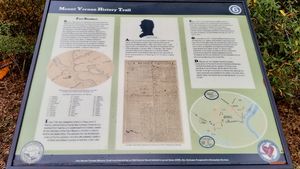
[[File:Fort Stoddert Panel.jpg|thumb|left|300px|Fort Stoddert Interpretive Panel.] | [[File:Fort Stoddert Panel.jpg|thumb|left|300px|Fort Stoddert Interpretive Panel.]] | ||
Established in 1799 by Captain [[Bartholomew Schaumburgh]], [[2nd U.S. Infantry]] as a stockaded fort with blockhouses in two of the four corners. The fort was located at the western end of the Federal Road from [[Fort Wilkinson]] in Georgia. | Established in 1799 by Captain [[Bartholomew Schaumburgh]], [[2nd U.S. Infantry]] as a stockaded fort with blockhouses in two of the four corners. The fort was located at the western end of the Federal Road from [[Fort Wilkinson]] in Georgia. | ||
| Line 16: | Line 16: | ||
During the [[Creek Indian War]] General [[Ferdinand L. Claiborne]] posted his Mississippi Militia to the fort and distributed troops to the many settler forts in the area. He moved his headquarters in 1814 and Fort Stoddard was abandoned. | During the [[Creek Indian War]] General [[Ferdinand L. Claiborne]] posted his Mississippi Militia to the fort and distributed troops to the many settler forts in the area. He moved his headquarters in 1814 and Fort Stoddard was abandoned. | ||
{{Clr}} | |||
== Current Status == | == Current Status == | ||
Marker and interpretive panels in and around the town of Mount Vernon in Mobile County, Alabama. The marker itself is located in the northeast corner of the intersection of the Old Military Road and Old U.S. 43. A series of six interpretive panels are strung out along the Old Military Road as it travels east from new U.S. Hwy 43 and then travels north parallel to the Mobile River. The last panel, #6, deals directly with Fort Stoddert but does not identify the exact location. | Marker and interpretive panels in and around the town of Mount Vernon in Mobile County, Alabama. The marker itself is located in the northeast corner of the intersection of the Old Military Road and Old U.S. 43. A series of six interpretive panels are strung out along the Old Military Road as it travels east from new U.S. Hwy 43 and then travels north parallel to the Mobile River. The last panel, #6, deals directly with Fort Stoddert but does not identify the exact location. | ||
Revision as of 07:36, 22 December 2017
|
Fort Stoddert (1799-1814) - A Federal Fort first established in 1799 in Mobile County, Alabama. Named Fort Stoddert after Benjamin Stoddert, first Secretary of the Navy (1798-1801). Abandoned in 1814. Also known as Fort Stoddart and Fort Stoddard.
History Established in 1799 by Captain Bartholomew Schaumburgh, 2nd U.S. Infantry as a stockaded fort with blockhouses in two of the four corners. The fort was located at the western end of the Federal Road from Fort Wilkinson in Georgia. Aaron Burr was held prisoner here for several days after his capture in 1807 for treason against the United States. Burr, who was disguised as a river boatman, was arrested by the fort commander Lieutenant Edmund P. Gaines. During the Creek Indian War General Ferdinand L. Claiborne posted his Mississippi Militia to the fort and distributed troops to the many settler forts in the area. He moved his headquarters in 1814 and Fort Stoddard was abandoned.
Current StatusMarker and interpretive panels in and around the town of Mount Vernon in Mobile County, Alabama. The marker itself is located in the northeast corner of the intersection of the Old Military Road and Old U.S. 43. A series of six interpretive panels are strung out along the Old Military Road as it travels east from new U.S. Hwy 43 and then travels north parallel to the Mobile River. The last panel, #6, deals directly with Fort Stoddert but does not identify the exact location.
See Also: Sources:
Visited: 21 Dec 2017
| ||||||
