Fort Union (5): Difference between revisions
Jump to navigation
Jump to search
John Stanton (talk | contribs) No edit summary |
John Stanton (talk | contribs) No edit summary |
||
| Line 6: | Line 6: | ||
|- valign="top" | |- valign="top" | ||
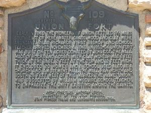
|width="50%"|[[File:Fort Union Marker-2.jpg|300px|thumb|left|Fort Union Marker]] | |width="50%"|[[File:Fort Union Marker-2.jpg|300px|thumb|left|Fort Union Marker]] | ||
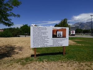
|width="50%"|[[ | |width="50%"|[[File:Fort Union Sign-2.jpg|300px|thumb|right|Fort Union Memorial Sign]] | ||
|- | |- | ||
|colspan="2"|[[File:Fort Union Marker-1.jpg|795px|thumb|center|Fort Union Marker Locale]] | |colspan="2"|[[File:Fort Union Marker-1.jpg|795px|thumb|center|Fort Union Marker Locale]] | ||
Revision as of 07:47, 27 July 2015
|
Fort Union (5) (1853-1870s) - A Mormon Settler Fort established in 1853 near Salt Lake City, Salt Lake County, Utah. Abandoned in 1870s. Also known as Union Fort.
History of Fort Union (5)A Mormon settler fort established in 1853 on 10 acres of land donated by Jehu Cox. The fort was built as a walled community enclosing some 23 homes and a community building used as a church, school and amusement hall. The surrounding wall was 12' tall made of stone and adobes with clay mortar. Abandoned by the 1870s. Current StatusMarker only in the middle of a shopping center.
See Also: Sources: Links: Visited: 5 Jul 2015
| ||||||


