Presidio of Tubac: Difference between revisions
Jump to navigation
Jump to search
John Stanton (talk | contribs) No edit summary |
John Stanton (talk | contribs) No edit summary |
||
| Line 5: | Line 5: | ||
|- valign="top" | |- valign="top" | ||
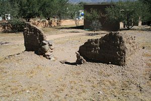
|width="50%"|[[Image:Presidio Tubac - 06.jpg|300px|thumb|left|Adobe Ruins at Presidio of Tubac]] | |width="50%"|[[Image:Presidio Tubac - 06.jpg|300px|thumb|left|Adobe Ruins at Presidio of Tubac]] | ||
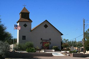
|width="50%"|[[Image:.jpg|300px|thumb|right| | |width="50%"|[[Image:Presidio Tubac St Ann's.jpg|300px|thumb|right|Presidio of Tubac, St. Ann's Church]] | ||
|- | |- | ||
|colspan="2"|<!--[[Image:.jpg|795px|thumb|center|Fort Presidio of Tubac]]--> | |colspan="2"|<!--[[Image:.jpg|795px|thumb|center|Fort Presidio of Tubac]]--> | ||
Revision as of 12:48, 15 October 2012
Presidio of Tubac (1752-1776, 1787-1820) - A Spanish Presidio established in 1752 in Pimeria Alta (place of the upper Pimas) in present day Santa Cruz County, Arizona. Abandoned in 1776. Reactivated in 1787. Also known as Presidio San Ignacio de Tubac. See also Camp Tubac.
 |
 |
Presidio of Tubac History
Current Status

Tubac Presidio State Historical Park, Santa Cruz County, Arizona
USGS Geographic Names Information System (GNIS) Database Entry: 36878
|
{"selectable":false,"width":"500"} |
Location: Tubac Presidio State Historical Park, Santa Cruz County, Arizona. Operated by the Tubac Historical Society and volunteers. Maps & Images Lat: 31.6114789 Long: -111.0459238 |
Sources:
- Roberts, Robert B., Encyclopedia of Historic Forts: The Military, Pioneer, and Trading Posts of the United States, Macmillan, New York, 1988, 10th printing, ISBN 0-02-926880-X, page 47
- Hart, Herbert M., Tour Guide to Old Western Forts, Pruett Publishing Co., Boulder CO, 1980, ISBN 0-87108-568-2,page 16
Links:
- North American Forts - Fort Presidio of Tubac
- Wikipedia - Tubac Presidio State Historic Park
- Arizona State Parks - Tubac Presidio State Historic Park
- Park Website
- Tubac Historical Society
- NPS - San Ignacio de Tubac
Visited: 31 Oct 2009
Presidio of Tubac Picture Gallery
|
Click on the picture to see a larger version. Contribute additional pictures - the more the better! |