File list
Jump to navigation
Jump to search
This special page shows all uploaded files.
| Date | Name | Thumbnail | Size | User | Description | Versions |
|---|---|---|---|---|---|---|
| 14:25, 23 October 2018 | Paragonah Fort Marker Text.jpg (file) |  |
475 KB | John Stanton (talk | contribs) | Paragonah Fort Marker Text, photo by John Stanton 23 Oct 2018 | 1 |
| 14:19, 23 October 2018 | Paragonah Fort Marker Loc.jpg (file) |  |
733 KB | John Stanton (talk | contribs) | Paragonah Fort Marker Location, photo by John Stanton 23 Oct 2018 | 1 |
| 14:04, 23 October 2018 | Iron County Courthouse.jpg (file) |  |
668 KB | John Stanton (talk | contribs) | Iron County Courthouse, photo by John Stanton 23 Oct 2018 | 1 |
| 07:27, 22 October 2018 | Topaz Museum Rec Bldg.jpg (file) |  |
180 KB | John Stanton (talk | contribs) | Topaz Museum Restored Half of a Rec Hall Building, photo by John Stanton 20 Oct 2018 | 1 |
| 07:19, 22 October 2018 | Topaz Museum Internee Display.jpg (file) |  |
205 KB | John Stanton (talk | contribs) | Topaz Museum Internee Display Photos also Showing Mess Hall Interior, photo by John Stanton 20 Oct 2018 | 1 |
| 06:46, 22 October 2018 | Topaz WRC Museum Plan Display.jpg (file) |  |
1.04 MB | John Stanton (talk | contribs) | Topaz Museum Display of the WRC Plan, photo by John Stanton 20 Oct 2018 | 1 |
| 06:30, 22 October 2018 | Topaz Museum Family Qtrs 2.jpg (file) |  |
147 KB | John Stanton (talk | contribs) | Replica Family Quarters Living Area at the Topaz Museum, photo by John Stanton 20 Oct 2018 | 1 |
| 06:21, 22 October 2018 | Topaz Museum Family Qtrs 1.jpg (file) |  |
152 KB | John Stanton (talk | contribs) | Replica Topaz WRC Family Quarters at the Topaz Museum, photo by John Stanton 20 Oct 2018 | 1 |
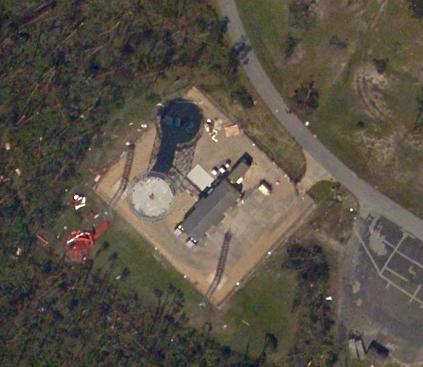
| 06:01, 22 October 2018 | Topaz WRC Water Towers.jpg (file) |  |
203 KB | John Stanton (talk | contribs) | Topaz WRC Water Towers and Perimeter Light Poles, public domain Topaz, Utah. A view of the water tower, which supplies water to the residents of this War Relocation Authority center, for evacuees of Japanese ancestry. Stewart, Francis, War Relocation A... | 1 |
| 20:18, 21 October 2018 | Topaz Cookstove Remains.jpg (file) |  |
189 KB | John Stanton (talk | contribs) | Topaz War Relocation Center Remains, photo by John Stanton 20 Oct 2018 | 1 |
| 20:08, 21 October 2018 | Topaz Internment Camp Memorial.jpg (file) |  |
141 KB | John Stanton (talk | contribs) | Topaz War Relocation Center Memorial, photo by John Stanton 20 Oct 2018 | 1 |
| 19:42, 21 October 2018 | Topaz Internent Camp Main St.jpg (file) |  |
477 KB | John Stanton (talk | contribs) | Topaz War Relocation Center Main Street, public domain, NARA - 538677, Parker, Tom, Photographer (NARA record: 4682167) - U.S. NARA Created: 18 October 1942 | 1 |
| 08:31, 21 October 2018 | Johnsons Fort Marker Text.jpg (file) |  |
316 KB | John Stanton (talk | contribs) | Johnson's Fort Marker Text, photo by John Stanton 19 Oct 2018 | 1 |
| 08:24, 21 October 2018 | Johnson's Fort Marker Display.jpg (file) |  |
720 KB | John Stanton (talk | contribs) | Johnson's Fort Marker & Display, photo by John Stanton 19 Oct 2018 | 1 |
| 17:55, 20 October 2018 | Fort Deseret Marker Text.jpg (file) |  |
533 KB | John Stanton (talk | contribs) | Fort Deseret Marker Text, photo by John Stanton 20 Oct 2018 | 1 |
| 17:36, 20 October 2018 | Fort Deseret Entrance.jpg (file) |  |
238 KB | John Stanton (talk | contribs) | Fort Deseret Entrance, photo by John Stanton 20 Oct 2018 | 1 |
| 17:25, 20 October 2018 | Fort Deseret Marker 1.jpg (file) |  |
269 KB | John Stanton (talk | contribs) | Fort Deseret Marker with For Wall in Background, photo by John Stanton 20 Oct 2018 | 1 |
| 17:13, 20 October 2018 | Fort Deseret NE Bastion.jpg (file) |  |
649 KB | John Stanton (talk | contribs) | Fort Deseret Northeast Bastion Ruins, photo by John Stanton 20 Oct 2018 | 1 |
| 07:57, 19 October 2018 | Cedar City NOAA Weather Radar.jpg (file) |  |
190 KB | John Stanton (talk | contribs) | Cedar City NOAA Doppler Weather Radar on Blowhard Mountain. Photo by John Stanton 18 Oct 2018 | 1 |
| 07:53, 19 October 2018 | Cedar City Radars frm Viewpoints.jpg (file) |  |
199 KB | John Stanton (talk | contribs) | Cedar City Radars from Cedar Breaks National Monument Viewpoint, photo by John Stanton 18 Oct 2018 | 1 |
| 07:45, 19 October 2018 | Cedar City FAA Radar Site.jpg (file) |  |
442 KB | John Stanton (talk | contribs) | Cedar City FAA Radar Site on Blowhard Mountain, photo by John Stanton 18 Oct 2018 | 1 |
| 07:47, 15 October 2018 | Tyndall AFB Radar 2018 Michael.jpg (file) |  |
102 KB | John Stanton (talk | contribs) | Tyndall AFB FAA Radar Site after Hurricane Michael, public domain [https://storms.ngs.noaa.gov/storms/michael/index.html#19/30.07600/-85.61059 NOAA Map] | 1 |
| 19:37, 14 October 2018 | Francis Peak FAA Radar Site.jpg (file) |  |
462 KB | John Stanton (talk | contribs) | Francis Peak FAA Radar Site, photo by John Stanton 14 Oct 2018 | 1 |
| 19:27, 13 October 2018 | Camp Floyd Plan.jpg (file) |  |
178 KB | John Stanton (talk | contribs) | Camp Floyd Plan from a Museum Display, photo by John Stanton 12 Oct 2018 | 1 |
| 19:18, 13 October 2018 | Camp Floyd Commissary Bldg.jpg (file) |  |
185 KB | John Stanton (talk | contribs) | Camp Floyd Original Commissary Building now a Museum, photo by John Stanton 12 Oct 2018 | 1 |
| 19:13, 13 October 2018 | Fairfield Stagecoach Inn.jpg (file) |  |
204 KB | John Stanton (talk | contribs) | Fairfield Stagecoach Inn, photo by John Stanton 12 Oct 2018 | 1 |
| 18:43, 13 October 2018 | Camp Floyd State Park Entrance.jpg (file) |  |
541 KB | John Stanton (talk | contribs) | Camp Floyd State Park Entrance, Stage Coach Inn on Left, the Commissary building on the Right, photo by John Stanton 12 Oct 2018 | 1 |
| 07:40, 7 October 2018 | NORAD CONAD Radar List 1958-06-30.pdf (file) | 699 KB | John Stanton (talk | contribs) | NORAD/CONAD List of Manual Radar Sites by Division a/o 30 Jun 1958 Appendix II, pp 124-129, public domain | 1 | |
| 08:30, 1 October 2018 | Bartlesville AFS Plan.png (file) |  |
532 KB | John Stanton (talk | contribs) | Bartlesville AFS Composite Plan, drawing by John Stanton 1 Oct 2018 | 1 |
| 11:34, 29 September 2018 | Fort Lawton AFS early 1960s.png (file) |  |
456 KB | John Stanton (talk | contribs) | Fort Lawton AFS circa early 1960s, Cropped, non attributed photo likely military from https://alchetron.com/Fort-Lawton#- CC-SA page | 1 |
| 07:08, 29 September 2018 | Fort Lawton Radar 1968.png (file) |  |
404 KB | John Stanton (talk | contribs) | Fort Lawton AFS Composite Plan, drawing by John Stanton 29 Sep 2018 | 1 |
| 07:37, 23 September 2018 | Ft Worden WWII Radars SCR-582 SCR-296.jpg (file) |  |
484 KB | John Stanton (talk | contribs) | Fort Worden WWII Radar Sites, SCR-582 Blister Left, SCR-296 Center, photo of an interpretive panel by John Stanton 27 May 2017 | 1 |
| 18:08, 21 September 2018 | OTS 69-07 Sq 7 May 69.jpg (file) |  |
4.57 MB | John Stanton (talk | contribs) | USAF Officer Training Class69-07 May 1969 | 1 |
| 07:58, 20 September 2018 | SCR-268 Block Diagram.png (file) |  |
323 KB | John Stanton (talk | contribs) | SCR-268 Block Diagram, drawing by John Stanton 20 Sep 2018 | 1 |
| 17:37, 19 September 2018 | SCR-286 radar and searchlight.jpg (file) |  |
84 KB | John Stanton (talk | contribs) | SCR-286 radar as a searchlight director, public domain [https://commons.wikimedia.org/wiki/File:SCR-286_radar_and_searchlight.jpg Wikimedia Commons] | 1 |
| 16:06, 19 September 2018 | SCR-268 Radar Soloman Islands.jpg (file) |  |
84 KB | John Stanton (talk | contribs) | SCR-268 Radar on Soloman Islands, public domain (copyright expired) Collection Database of the Australian War Memorial under the ID Number: 305374 | 1 |
| 13:59, 19 September 2018 | SCR-268A Morocco 1943.jpg (file) |  |
324 KB | John Stanton (talk | contribs) | SCR-268-A Deployed in Morocco in 1943, public domain {{LOC|DigitalID=https://www.archives.gov/files/research/african-americans/ww2-pictures/images/african-americans-wwii-004.jpg}} | 1 |
| 15:34, 14 September 2018 | Women of Bryans Station.jpg (file) |  |
495 KB | John Stanton (talk | contribs) | Women of Bryan's Station, public domain {{LOC|DigitalID=http://hdl.loc.gov/loc.pnp/pga.07759}} | 1 |
| 14:27, 13 September 2018 | Fort Ann Map Loc 1893 (1).jpg (file) | .jpg) |
166 KB | John Stanton (talk | contribs) | Extract of 1893 Map of Brevard County, public domain {{LOC|DigitalID=https://lccn.loc.gov/2012592399}} | 1 |
| 16:32, 10 September 2018 | Cape Meares Antenna Pier.jpg (file) |  |
682 KB | John Stanton (talk | contribs) | Cape Meares Radar Site Antenna Pier, photo by John Stanton 8 Sep 2018 | 1 |
| 15:57, 10 September 2018 | Cape Meares RS OPS from Ant.jpg (file) |  |
338 KB | John Stanton (talk | contribs) | Cape Meares RadarSite from the Antenna Piers, photo by John Stanton 8 Sep 2018 | 1 |
| 07:21, 10 September 2018 | Cape Meares RS Overgrowth.jpg (file) |  |
315 KB | John Stanton (talk | contribs) | Cape Meares WWII Radar Station Interior Overgrowth & Debris, photo by John Stanton 8 Sep 2018 | 1 |
| 07:16, 10 September 2018 | Cape Meares RS Gen Air Vent Detail (1).jpg (file) | .jpg) |
201 KB | John Stanton (talk | contribs) | Cape Meares WWII Radar Site Generator Air Intake Vent Detail, photo by John Stanton 8 Sep 2018 | 1 |
| 19:54, 9 September 2018 | Cape Meares RS OPS Entrance.jpg (file) |  |
273 KB | John Stanton (talk | contribs) | Cape Meares RS Operations Room Entrance, photo by John Stanton 8 Sep 2018 | 1 |
| 19:47, 9 September 2018 | Cape Meares RS Gen Room (3).jpg (file) | .jpg) |
239 KB | John Stanton (talk | contribs) | Cape Meares RS Generator Room, photo by John Stanton 8 Sep 2018 | 1 |
| 12:55, 9 September 2018 | Tillamook Head Wide Trail.jpg (file) |  |
359 KB | John Stanton (talk | contribs) | Tillamook Head Wide Trail, photo by John Stanton 8 Sep 2018]] | 1 |
| 12:51, 9 September 2018 | Tillamook Head Hikers Camp.jpg (file) |  |
228 KB | John Stanton (talk | contribs) | Tillamook Head Hikers Camp, photo by John Stanton 8 Sep 2018 | 1 |
| 12:36, 9 September 2018 | Tillamook Head Ant Piers.jpg (file) |  |
297 KB | John Stanton (talk | contribs) | Tillamook Head WWII Radar Site Antenna Piers, photo by John Stanton 8 Sep 2018 | 1 |
| 12:32, 9 September 2018 | Tillamook Head RS Gen Vents.jpg (file) |  |
341 KB | John Stanton (talk | contribs) | Tillamook Head WWII Radar Site Generator Air Intake Vents, photo by John Stanton 8 Sep 2018 | 1 |
| 12:20, 9 September 2018 | Tillamook Head RS Left Door.jpg (file) |  |
302 KB | John Stanton (talk | contribs) | Tillamook Head WWII Radar Site Left Entrance, photo by John Stanton 8 Sep 2018 | 1 |