File:Fort Desperate Topo Map.jpg
Size of this preview: 560 × 600 pixels.
Original file (800 × 857 pixels, file size: 1.03 MB, MIME type: image/jpeg)
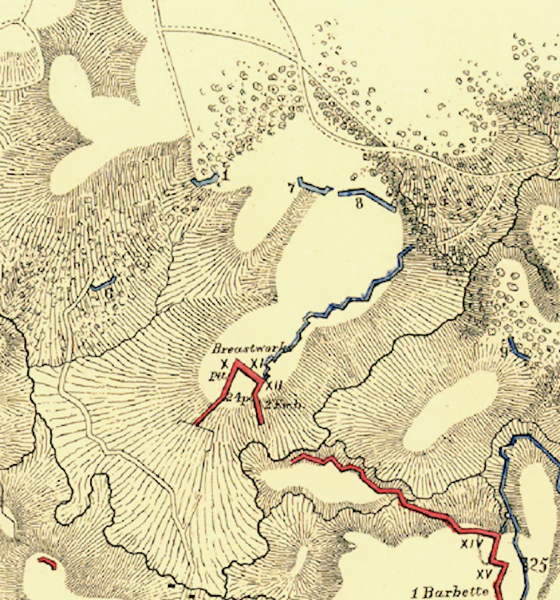
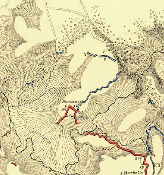
Fort Desperate Topo Map, public domain, Map of Port Hudson and vicinity Prepared by order of Major General N. P. Banks under the direction of Major D. C. Houston, Chief Engineer, Department of the Gulf and Captain Peter C. Hains, Corps of Engr's. 1864. Published by authority of the Hon. the Secretary of War., Office of the Chief of Engineers, U.S. Army 1875. Library of Congress, Captain Peter C. Hains http://hdl.loc.gov/loc.gmd/g4014p.cw0238000
File history
Click on a date/time to view the file as it appeared at that time.
| Date/Time | Thumbnail | Dimensions | User | Comment | |
|---|---|---|---|---|---|
| current | 13:56, 7 January 2019 | | 800 × 857 (1.03 MB) | John Stanton (talk | contribs) | Fort Desperate Topo Map, public domain, Map of Port Hudson and vicinity Prepared by order of Major General N. P. Banks under the direction of Major D. C. Houston, Chief Engineer, Department of the Gulf and Captain Peter C. Hains, Corps of Engr's. 1864.... |
You cannot overwrite this file.
File usage
The following page uses this file: