Presidio of Tubac
Presidio of Tubac (1752-1776, 1787-1820) - A Spanish Presidio established in 1752 in Pimeria Alta (place of the upper Pimas) in present day Santa Cruz County, Arizona. Abandoned in 1776. Reactivated in 1787. Also known as Presidio San Ignacio de Tubac and later as Camp Tubac.
 |
 |
The Spanish Period (1752-1821)
A Spanish Presidio established in 1752 as the most northern Presidio in Pimeria Alta (place of the upper Pimas). The Presidio was situated on what became the road to California and San Francisco. Frequent Apache raids caused the presidio to be abandoned 1776 in favor of the Presidio of Tucson. The presidio was regarrisoned in 1787.
The Mexican Period (1822-1853)
The Mexican War of Independence brought the Presidio and the mission system under the control of the new Mexican Government which issued an order in 1833 to secularize the presidios and the missions. Control of presidio and mission lands was eventually taken way from the church and distributed to private persons. The southern part of Arizona remained under Mexican control after the Mexican War with the United States and in 1853 the Gadsden Purchase gave the U.S. Government control over all of present day Arizona including the presidios and missions.
U.S. Civil War (1861-1862)
Camp Tubac was established near the ruins of the old presidio on 20 Jul 1862 by troops of the 1st U.S. Cavalry and 2nd U.S. Cavalry. The supply camp was abandoned in August 1865 at the end of the war. It was reoccupied from 1866 to 1868 and then abandoned.
Current Status

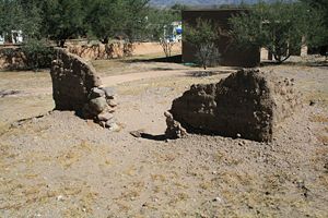
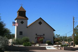
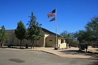
Tubac Presidio State Historical Park, Santa Cruz County, Arizona. Displays include adobe ruins, an underground archeology display of early foundations and a visitor center. The park was scheduled for closure in 2010 due to budget cutbacks but is now now operated by the Tubac Historical Society and volunteers.
USGS Geographic Names Information System (GNIS) Database Entry: 36878
|
{"selectable":false,"width":"500"} |
Location: Tubac Presidio State Historical Park, Santa Cruz County, Arizona. Operated by the Tubac Historical Society and volunteers. Maps & Images Lat: 31.6114789 Long: -111.0459238 |
Sources:
- Roberts, Robert B., Encyclopedia of Historic Forts: The Military, Pioneer, and Trading Posts of the United States, Macmillan, New York, 1988, 10th printing, ISBN 0-02-926880-X, page 47
- Hart, Herbert M., Tour Guide to Old Western Forts, Pruett Publishing Co., Boulder CO, 1980, ISBN 0-87108-568-2,page 16
Links:
- North American Forts - Fort Presidio of Tubac
- Wikipedia - Tubac Presidio State Historic Park
- Arizona State Parks - Tubac Presidio State Historic Park
- Park Website
- Tubac Historical Society
- NPS - San Ignacio de Tubac
Visited: 31 Oct 2009
Presidio of Tubac Picture Gallery
|
Click on the picture to see a larger version. Contribute additional pictures - the more the better! |