Fort Allen (2): Difference between revisions
John Stanton (talk | contribs) No edit summary |
John Stanton (talk | contribs) No edit summary |
||
| Line 5: | Line 5: | ||
|- valign="top" | |- valign="top" | ||
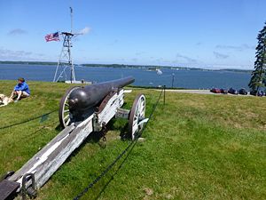
|width="50%"|[[Image:Fort Allen - 08.jpg|300px|thumb|left|Civil War Era Cannon on Fort Allen Earthworks]] | |width="50%"|[[Image:Fort Allen - 08.jpg|300px|thumb|left|Civil War Era Cannon on Fort Allen Earthworks]] | ||
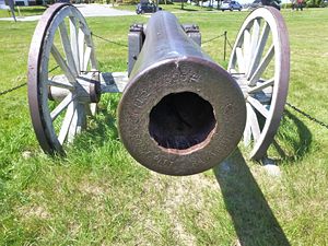
|width="50%"|[[Image:.jpg|300px|thumb|right| | |width="50%"|[[Image:Fort Allen - 04.jpg|300px|thumb|right|Civil War Era Cannon Muzzle]] | ||
|- | |- | ||
|colspan="2"|[[Image:Fort Allen - 01.jpg|795px|thumb|center|The View from the Site of Fort Allen]] | |colspan="2"|[[Image:Fort Allen - 01.jpg|795px|thumb|center|The View from the Site of Fort Allen]] | ||
Revision as of 14:52, 18 June 2012
Fort Allen (2) (1775, 1814-1815) - A Revolutionary War fortification established in 1775 by patriot forces in Portland, Cumberland County, Maine. Named for Colonel Ethan Allen who captured Fort Ticonderoga in May 1775. Used as a hospital during the War of 1812 and abandoned in 1815. Also known as Fort Ethan Allen.
 |
 |
 | |
Fort Allen (2) History
Initially built with five guns in a crescent shaped battery for the defense of Portland, Maine. It was later enlarged to include a barracks and magazine. In the War of 1812 parts of the fort were used as a hospital.
Current Status
Part of Fort Allen City Park in Portland, Cumberland County, Maine. Two civil war era guns are emplaced on period earthworks.
|
{"selectable":false,"width":"500"} |
Location: Fort Allen City Park, Portland, Cumberland County, Maine. Maps & Images Lat: 43.665595 Long: -70.240752 |
Sources:
- Roberts, Robert B., Encyclopedia of Historic Forts: The Military, Pioneer, and Trading Posts of the United States, Macmillan, New York, 1988, 10th printing, ISBN 0-02-926880-X, page 357
Links:
Visited: No
Fort Allen (2) Picture Gallery
|
Click on the picture to see a larger version. Contribute additional pictures - the more the better! |