Point Vicente Military Reservation: Difference between revisions
John Stanton (talk | contribs) No edit summary |
John Stanton (talk | contribs) No edit summary |
||
| Line 67: | Line 67: | ||
'''Sources:''' | '''Sources:''' | ||
* Berhow, Mark A. and Gustafson, David, '''''The Guardian at Angels Gate Fort MacArthur Defender of Los Angeles''''', CDSG ePress electronic edition, 2011, 99 pages, [http://www.cdsg.org/HDpac/FtMacBook11.pdf Large pdf] | |||
* USACE, '''''FUDS - Archives Search Report Findings - Point Vicente Seacoast Defense Sites''''', USACE Project Number J09CA055802, April 1996, USACE St. Louis District, 301 Pages, [ftp://swrcb2a.swrcb.ca.gov/pub/swrcb/dwq/dodscp/CA%20INPRS%20and%20ASRs%20LA%20District/ASRs/J09CA055802.pdf Large pdf] | |||
{{HBSuppLosAngelesWWII}} | {{HBSuppLosAngelesWWII}} | ||
Revision as of 16:07, 12 January 2013
Point Vicente Military Reservation (1942-1974) - An Coastal Military Reservation first established in 1942 above Long Point and Point Vincente in the present day city of Rancho Palos Verdes, Los Angeles County, California. A sub-post of Fort MacArthur. Abandoned in 1974.
 |
 |
World War II (1941-1945)
Part of the Harbor Defense of Los Angeles.

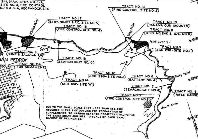
The majority of the land (107.77 acres in two tracts) for the Point Vicente Military Reservation was purchased from the Palos Verdes Corporation in January 1942. An additional .22 acres was obtained from the Coast Guard at Point Vicente by verbal agreement. Improvements over the years placed Battery 240 and some twenty-four support buildings or structures and a small arms rifle range.
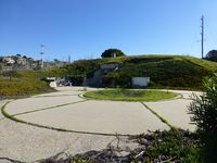
Construction on the modern 6" twin gun Battery 240 began in 1942 and was completed with the proof firing of the guns in October 1943. Battery 240 was located on the upper level of the reservation overlooking Point Vincente. Two fire control stations were built at FC Site #3 behind Battery 240 higher up in the hills at the 500' level. These fire control stations serviced Battery 240, Battery 241, Battery 127 and would have serviced Battery 128 had it been armed.
Two SCR-296 Radar fire control stations were built even higher up in the hills at the 700' and 1000' levels. These Radar sites serviced Battery 240 and Battery 127.
| Battery Click on Battery links below |
No. | Caliber | Type Mount | Service Years | Battery Cost | Notes |
|---|---|---|---|---|---|---|
| Battery 240 | 2 | 6" | Shielded Barbette (SBC) | 1942-1943-1943-1956 | $ 219,000 | |
| Source: CDSG | ||||||


Cold War (1947–1991)


A NIKE missile launch and administrative site LA-55L was located on the Point Vicente Military Reservation in 1956. The site consisted of a launch facility/magazine and and a barracks/administrative facility. The launch/magazine facility is now a maintenance yard for the city of Rancho Palos Verdes and the barracks/administrative facility is the city hall complex.
A separate control site LA-55C was located in the hills above the launch site. The control site housed the Radar (AN/FPS-71, AN/FPA-16) and communications equipment for controlling the missile intercepts of hostile enemy aircraft.
The NIKE systems at the Point Vicente Military Reservation evolved with the NIKE program into an advanced aircraft interceptor missile system with a nuclear capability. In the 1970s the threat changed from long range bomber attacks to intercontinental nuclear missile attacks and the NIKE system became obsolete. In 1974 the NIKE system was deactivated and the NIKE facilities at Point Vicente MR were closed.
The abandoned site was first offered to Federal agencies and the U.S. Coast Guard retained their original land and some 20 acres including a portion of the site that included Battery 240 for a communications site. In the end, the newly formed city of Rancho Palos Verdes obtained title to 75.53 acres of the former military reservation and the NIKE control site above it. Los Angeles County obtained 10.53 acres for Point Vicente County Park.
| Battery | Type | Location | GPS | Dates | Notes |
|---|---|---|---|---|---|
| LA-55C | Control | Above Point Vicente MR | 33.758007, -118.368094 |
1956-1974 | |
| LA-55L | Launch | Point Vicente MR | 33.74375, -118.403773 |
1956-1974 | |
| Source: Fort MacArthur - NIKE, Wikipedia - California NIKE Stes | |||||
Current Status
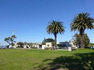
Most of the old military reservation site is owned by the City of Rancho Palos Verdes, Los Angeles County, California. The city hall and other city facilities are located on the former military reservation. The area around gun emplacement #2 of Battery 240 is marked with U.S. Government signs. Access to the former NIKE launch site and magazine is restricted by city signs but nearly all of the sites can be photographed from unrestricted areas.
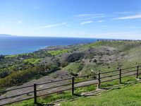
The NIKE control site above the old military reservation is now the Del Cerro City Park with no remnants or mention of the military facilities. The view of the California coast and Catalina Island is spectacular from this site.
|
{"selectable":false,"width":"500"} |
Location: City Hall, Rancho Palos Verdes, Los Angeles County, California. Maps & Images Lat: 33.7447911 Long: -118.4045523 |
Recent Blog Posts:
Sources:
- Berhow, Mark A. and Gustafson, David, The Guardian at Angels Gate Fort MacArthur Defender of Los Angeles, CDSG ePress electronic edition, 2011, 99 pages, Large pdf
- USACE, FUDS - Archives Search Report Findings - Point Vicente Seacoast Defense Sites, USACE Project Number J09CA055802, April 1996, USACE St. Louis District, 301 Pages, Large pdf
- U.S.Army, Supplement to the Harbor Defense Project Harbor Defenses of Los Angeles, (LA-AN-WDC-44), 31 Aug 1944, CDSG
Links:
- North American Forts - Long Point Military Reservation
- California Military Museum - Long Point Military Reservation
- Fort MacArthur - Nike
- CDSG
Visited: 4 Jan 2013
Point Vicente Military Reservation Picture Gallery
|
Click on the picture to see a larger version. Contribute additional pictures - the more the better! |