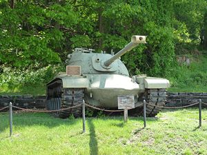
Camp Smith (1): Difference between revisions
Bill Thayer (talk | contribs) m typo |
John Stanton (talk | contribs) No edit summary |
||
| Line 26: | Line 26: | ||
| | | | ||
<googlemap version="0.9" lat="41.301531" lon="-73.941615" zoom="15" width="500" scale="yes" overview="yes" controls="large" icons="http://www.fortwiki.com/mapicons/icon{label}.png"> | <googlemap version="0.9" lat="41.301531" lon="-73.941615" zoom="15" width="500" scale="yes" overview="yes" controls="large" icons="http://www.fortwiki.com/mapicons/icon{label}.png"> | ||
(F) 41.301531, -73.941615 | (F) 41.301531, -73.941615, Camp Smith | ||
Camp Smith | (1882-Present) | ||
</googlemap> | </googlemap> | ||
|valign="top"| | |valign="top"| | ||
| Line 35: | Line 35: | ||
* Elevation: .....' | * Elevation: .....' | ||
|} | |} | ||
'''See Also:''' | |||
* [[United States Military Academy]] | |||
* [[West Point Portal]] | |||
'''Sources:''' | '''Sources:''' | ||
| Line 45: | Line 49: | ||
{{Visited|10 May 2012}} | {{Visited|10 May 2012}} | ||
<!-- | |||
=={{PAGENAME}} Picture Gallery== | =={{PAGENAME}} Picture Gallery== | ||
{{PictureHead}} | {{PictureHead}} | ||
<gallery> | <gallery> | ||
</gallery> | </gallery> | ||
--> | |||
__NOTOC__ | __NOTOC__ | ||
Revision as of 18:14, 25 January 2015
Camp Smith (1) (1882-Present) - First established as a National Guard Training Camp in 1882 as Camp Townsend by Major General Frederick Townsend in Westchester County, New York. Renamed State Camp of Instruction in 1913 and in 1932 renamed Camp Smith for New York Governor Alfred E. Smith. Active Military Installation.
 |
 |
 | |
Camp Townsend
Established as a National Guard Training Camp in 1882 as Camp Townsend by Major General Frederick Townsend in Westchester County, New York. Used as one of two mustering in camps for the Spanish American War along with Camp Black on Long Island.
Current Status
Active Military Installation in Westchester County, New York. A training camp for the United States Military Academy and New York State National Guard.
|
{"selectable":false,"width":"500"} |
Location: North of Peekskill on Route 6, Westchester County, New York. Maps & Images Lat: 41.301531 Long: -73.941615 |
See Also:
Sources:
- Roberts, Robert B., Encyclopedia of Historic Forts: The Military, Pioneer, and Trading Posts of the United States, Macmillan, New York, 1988, 10th printing, ISBN 0-02-926880-X, page 580-581
Links:
Visited: 10 May 2012