Sweetwater Air Force Station: Difference between revisions
John Stanton (talk | contribs) |
John Stanton (talk | contribs) No edit summary |
||
| Line 12: | Line 12: | ||
Established in 1956 and became operational in 1956 as Sweetwater Air Force Station manned by the 683rd AC&W Squadron. The station initially had both a Ground-Control Intercept (GCI) and early warning misssion. The early warnng mission involved tracking and identifing all aircraft entering their airspace while the GCI mission involved guiding Air Force interceptors to any identified enemy aircraft. Controllers at the station vectored fighter aircraft at the correct course and speed to intercept enemy aircraft using voice commands via ground-to-air radio. | Established in 1956 and became operational in 1956 as Sweetwater Air Force Station manned by the 683rd AC&W Squadron. The station initially had both a Ground-Control Intercept (GCI) and early warning misssion. The early warnng mission involved tracking and identifing all aircraft entering their airspace while the GCI mission involved guiding Air Force interceptors to any identified enemy aircraft. Controllers at the station vectored fighter aircraft at the correct course and speed to intercept enemy aircraft using voice commands via ground-to-air radio. | ||
Initial equipment included the MPS-11 search radar and a TPS-10D height finder radar. The TPS-10D was replaced by an FPS-6A Height Finder in 1961 and it was later upgraded to an FPS-90. The MPS-11 was replaced by an FPS-67B in the mid 1960s. Sweetwater AFS and the 683rd were deactivated in 1969. | Initial equipment included the [[MPS-11]] search radar and a [[TPS-10|TPS-10D]] height finder radar. The TPS-10D was replaced by an [[FPS-6A]] Height Finder in 1961 and it was later upgraded to an [[FPS-90]]. The [[MPS-11]] was replaced by an [[FPS-67B]] in the mid 1960s. Sweetwater AFS and the 683rd were deactivated in 1969. | ||
Sweetwater AFS | From 1960 to 1966 the Army Air Defense Command Post (AADCP) controlling the Dyess Nike-Hercules anti-aircraft missile sites (DY-10 and DY-50) was co-located with the Sweetwater AFS radar operations. The AADCP used the CSG-5 Battery Integration and Radar Display Equipment (BIRDIE) with inputs from the USAF radars. | ||
== Gap Filler Radars == | |||
Sweetwater AFS was responsible for the maintenance of two remote unattended gap filler radar sites. {{GapFillerCommon}} The Sweetwater AFS gap filler radars were located at Big Spring and Sidney, Texas. | |||
== Physical Plant == | |||
[[File:Sweetwater AFS Housing-1.jpg|thumb|left|200px| Former Sweetwater AFS Base Housing, Locked Up]] | [[File:Sweetwater AFS Housing-1.jpg|thumb|left|200px| Former Sweetwater AFS Base Housing, Locked Up]] | ||
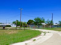
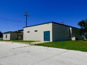
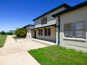
The radar site was housed in a relatively small compound on the west side of Avenger Field, the Sweetwater municipal airport. The physical plant of the site was divided into a main site on the east side of the compound, a cantonment area on the north end, a housing area on the other side of the airport and a radio site in the south end. The main site housed the operations building, the radar towers, the C & E Building and the backup generators. The cantonment area housed the enlisted barracks, the bachelor officer's quarters, the orderly room, the dining hall, the motor pool and other support buildings. The cantonment area also housed a large recreation building that contained the BX, photo lab and library. Apart from the main compound was a separate compound on the east side of the airport with a small 24 unit housing area for critical married personnel. A Ground to Air Transmitter/Receiver (GATR) radio site on the south end of the compound housed the radio equipment for directing aircraft intercepts. | The radar site was housed in a relatively small compound on the west side of Avenger Field, the Sweetwater municipal airport. The physical plant of the site was divided into a main site on the east side of the compound, a cantonment area on the north end, a housing area on the other side of the airport and a radio site in the south end. The main site housed the operations building, the radar towers, the C & E Building and the backup generators. The cantonment area housed the enlisted barracks, the bachelor officer's quarters, the orderly room, the dining hall, the motor pool and other support buildings. The cantonment area also housed a large recreation building that contained the BX, photo lab and library. Apart from the main compound was a separate compound on the east side of the airport with a small 24 unit housing area for critical married personnel. A Ground to Air Transmitter/Receiver (GATR) radio site on the south end of the compound housed the radio equipment for directing aircraft intercepts. | ||
| Line 34: | Line 36: | ||
|- | |- | ||
| valign="top" | | | valign="top" | | ||
* FPS-3 | * [[FPS-3]] | ||
* FPS-20 | * [[FPS-20]] | ||
* MPS-11 | * [[MPS-11]] | ||
* FPS-67A | * [[FPS-20|FPS-67A]] | ||
| valign="top" | | | valign="top" | | ||
* TPS-10D | * [[TPS-10D]] | ||
* FPS-6A | * [[FPS-6|FPS-6A]] | ||
* FPS-90 | * [[FPS-90]] | ||
| valign="top" | | | valign="top" | | ||
|} | |} | ||
| Line 57: | Line 59: | ||
|- | |- | ||
| | | | ||
* 1 Dec 1953 - | * 1 Dec 1953 - Activated at Geiger Field, WA, as the 4702nd Defense Wing. | ||
* by Jan 1954 - | * by Jan 1954 - Moved to Tinker AFB, OK and transferred to 33rd Air Division. | ||
* early 1956 - | * early 1956 - Moved to Sweetwater AFS, TX. | ||
* 1 Jan 1960 - | * 1 Jan 1960 - Transferred to Albuquerque ADS. | ||
* 15 Sep 1960 - | * 15 Sep 1960 - Transferred to Oklahoma City ADS. | ||
* 1 Sep 1961 - | * 1 Sep 1961 - Transferred to 4752nd Air Defense Wing. | ||
* 25 Jun 1963 - | * 25 Jun 1963 - Transferred to Oklahoma City ADS. | ||
* 1 Apr 1966 - | * 1 Apr 1966 - Reassigned to 31st Air Division. | ||
* 30 Sep 1969 - | * 30 Sep 1969 - Inactivated. | ||
|} | |} | ||
| Line 141: | Line 143: | ||
[[Category:SAGE Sites]] | [[Category:SAGE Sites]] | ||
[[Category:Dyess NIKE Sites]] | [[Category:Dyess NIKE Sites]] | ||
[[Category:FPS-3]] | |||
[[Category:FPS-20]] | |||
[[Category:MPS-11]] | |||
[[Category:FPS-67]] | |||
[[Category:TPS-10]] | |||
[[Category:FPS-6]] | |||
[[Category:FPS-90]] | |||
[[Category:2015 Research Trip]] | [[Category:2015 Research Trip]] | ||
Revision as of 13:20, 28 October 2015
|
Sweetwater Air Force Station (1956-1969) - A Cold War Air Force Radar Station first established in 1956 near Sweetwater, Nolan County, Texas. Named Sweetwater Air Force Station after the location. Initially assigned a Permanent ID of M-89, later a Sage ID of Z-89. Abandoned as an Air Force Station in 1969. History of Sweetwater Air Force StationEstablished in 1956 and became operational in 1956 as Sweetwater Air Force Station manned by the 683rd AC&W Squadron. The station initially had both a Ground-Control Intercept (GCI) and early warning misssion. The early warnng mission involved tracking and identifing all aircraft entering their airspace while the GCI mission involved guiding Air Force interceptors to any identified enemy aircraft. Controllers at the station vectored fighter aircraft at the correct course and speed to intercept enemy aircraft using voice commands via ground-to-air radio. Initial equipment included the MPS-11 search radar and a TPS-10D height finder radar. The TPS-10D was replaced by an FPS-6A Height Finder in 1961 and it was later upgraded to an FPS-90. The MPS-11 was replaced by an FPS-67B in the mid 1960s. Sweetwater AFS and the 683rd were deactivated in 1969. From 1960 to 1966 the Army Air Defense Command Post (AADCP) controlling the Dyess Nike-Hercules anti-aircraft missile sites (DY-10 and DY-50) was co-located with the Sweetwater AFS radar operations. The AADCP used the CSG-5 Battery Integration and Radar Display Equipment (BIRDIE) with inputs from the USAF radars. Gap Filler RadarsSweetwater AFS was responsible for the maintenance of two remote unattended gap filler radar sites. The unattended gap filler sites were placed in locations where the main search radar lacked coverage. These sites were equipped with short range FPS-14 or FPS-18 search radars and FST-1 Coordinate Data transmitters that sent digitized radar target data to a SAGE direction center and to the main radar site. Both the radar set and the FST-1 were dual channel to increase site up time. Maintenance teams were dispatched for regularly scheduled maintenance or when fault indicators on the FSW-1 remote monitoring equipment suggested the site had problems. The FSW-1 also allowed remote operation of specific functions such as channel changes for the radar and for the FST-1, it also allowed remote operation of the diesel generators at the gap filler site. The Sweetwater AFS gap filler radars were located at Big Spring and Sidney, Texas. Physical Plant The radar site was housed in a relatively small compound on the west side of Avenger Field, the Sweetwater municipal airport. The physical plant of the site was divided into a main site on the east side of the compound, a cantonment area on the north end, a housing area on the other side of the airport and a radio site in the south end. The main site housed the operations building, the radar towers, the C & E Building and the backup generators. The cantonment area housed the enlisted barracks, the bachelor officer's quarters, the orderly room, the dining hall, the motor pool and other support buildings. The cantonment area also housed a large recreation building that contained the BX, photo lab and library. Apart from the main compound was a separate compound on the east side of the airport with a small 24 unit housing area for critical married personnel. A Ground to Air Transmitter/Receiver (GATR) radio site on the south end of the compound housed the radio equipment for directing aircraft intercepts.
Current StatusNow the Rolling Plains campus of Texas State Technical Institute in Sweetwater, Nolan County, Texas. While some of the original building remain on the main site and cantonment area, most are gone. The recreation building and the operations building have been repurposed. No sign of the two radar towers. The housing area still exists but is gated and appears to be deteriorating. The map below outlines the main areas of the former radar station with the main site and the radio site outlined in red.
See Also: Sources:
Visited: 29 Apr 2015
|


