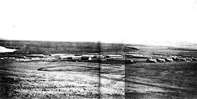
Fort Abraham Lincoln


Fort Abraham Lincoln (1872-1891) - Constructed in June 1872 by Companies B and C of the 6th U.S. Infantry to protect the construction of the Northern Pacific Railroad. The fort was first named Fort McKeen and then changed to Fort Abraham Lincoln on 19 Nov 1872. Congress authorized the addition of a Cavalry Post in 1873. Lt. Col.(Bvt Major General) George Armstrong Custer was the first commander of the enlarged fort and served here from 1873 until the Battle of the Little Big Horn in 1876.
Fort Abraham Lincoln History
By 1874 the fort housed 9 companies with about 650 men, three companies of the 6th U.S. Infantry and 17th U.S. Infantry and six companies of the 7th U.S. Cavalry. The fort was among the largest and most important on the Northern Plains.
Fort Abraham Lincoln remained the headquarters of the 7th U.S. Cavalry until June of 1882, when the 7th U.S. Cavalry and its headquarters were transferred to Fort Meade in South Dakota. After the railroad to Montana was complete the fort gradually declined in importance and was finally abandoned in 1891.
At its height Fort Abraham Lincoln had 78 separate buildings. Many of those original buildings were dismantled by settlers and used in the construction of homes and farms.
Current Status
President Theodore Roosevelt signed the deed to the land to the state in 1907 as Fort Abraham Lincoln State Park. In 1934, the Civilian Conservation Corps built a visitor center, shelters, and roads. They also reconstructed military blockhouses and placed cornerstones to mark where fort buildings once stood, as well as replicating Mandan earthen lodges. Additional reproductions have since been built on the site creating a replica Mandan village, called "On-a-Slant Village." The park also includes a campground and picnic area.²
The Victorian-style home of George and Libbie Custer has been reconstructed and is open for tours. The commissary storehouse, the enlisted men's barracks, the granary and the stable have also been reconstructed.
|
{"selectable":false,"width":"500"} |
Location: Seven miles south of today's Mandan, North Dakota Maps & Images Lat: 46.759092 Long: -100.84548 |
Links:
Sources:
- Field, Ron, Forts of the American Frontier 1820-91: Central and Northern Plains, Osprey Publishing, Elms Court, Chapel Way, Botley, Oxford OX2 9LP, United Kingdom, 2005, ISBN: 1 84176 775 1
- Wikipedia
- Frazer, Robert W., Forts of the West, University of Oklahoma Press, Norman OK, 1965, ISBN 0-8061-1250-6, page 111
- Hart, Herbert M., Tour Guide to Old Western Forts, Pruett Publishing Co., Boulder CO, 1980, ISBN 0-87108-568-2, page 112
Visited: No
Picture Gallery
|
Click on the picture to see a larger version. Contribute additional pictures - the more the better! |