Fort Rains
|
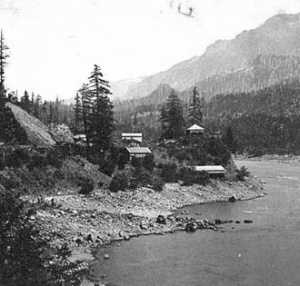
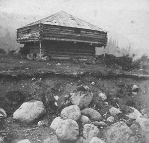
Fort Rains (1855-18??) - A blockhouse built in Oct 1855 to defend the Middle Cascades. The location of this structure was on the north bank of the Columbia above the present site of the Bonneville Dam and below the Bridge of the Gods. Fort Rains was named for Major Gabriel Rains (Cullum 482) who supervised the construction.
Fort Rains HistoryFort Rains was one of three forts established to protect the required portage around the Cascade Rapids of the Columbia River. Fort Cascades was built at the lower end of the rapids to protect the portage road. Fort Rains was built to protect the middle section of the portage and Fort Lugenbeel was located at the beginning of the portage. On 26 Mar 1856, a group of Yakama and Cascade Indians attacked the white settlements at the Cascades. Settlers took refuge at Fort Rains and Bradford's Store. Fort Cascades was burned to the ground. On 27 Mar, 40 dragoons arrived from The Dalles under Lieutenant Philip H. Sheridan. Sheridan attempted to attack Indians engaged in horse races at the upper landing, but his movement was compromised by the bugles from a larger force under Lieutenant Edward J. Steptoe. Gunfire was exchanged the rest of the 27th and 28th, with the Indians surrendering late in the evening on 28 Mar 1856. The Yakamas fled leaving the Cascades behind. The Cascade Indians surrendered without a fight. Steptoe summarily tried and hanged nine of the Cascade Indians.
Source: Links: Visited: Sep 2005 Picture Gallery
|
|||||||

