Mill Rock Fort: Difference between revisions
John Stanton (talk | contribs) No edit summary |
John Stanton (talk | contribs) No edit summary |
||
| Line 13: | Line 13: | ||
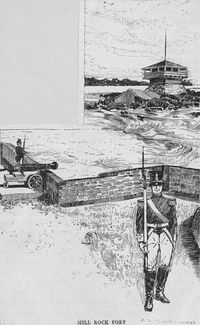
[[File:Mill Rock Fort 1814.jpg|thumb|left|200px|Mill Rock Fort 1814]] | [[File:Mill Rock Fort 1814.jpg|thumb|left|200px|Mill Rock Fort 1814]] | ||
Established in 1812 as a coastal defense in the East River of New York City. Built to defend the East River channels with a gun battery and a large supporting blockhouse. | Established in 1812 as a coastal defense in the East River of New York City. Built to defend the East River channels with a gun battery and a large supporting blockhouse. | ||
{{NYCForts1814}} | |||
Abandoned as a fortification at the end of the war in 1815. Burned down in 1821. | Abandoned as a fortification at the end of the war in 1815. Burned down in 1821. | ||
Revision as of 10:11, 12 January 2016
|
Mill Rock Fort (1812-1815) - A War of 1812 fortification established in 1812 on Mill Rock Island in present day New York County, New York. Abandoned as a fortification at the end of the war in 1815.
History of Mill Rock Fort Established in 1812 as a coastal defense in the East River of New York City. Built to defend the East River channels with a gun battery and a large supporting blockhouse.  This fortification was one of a line running diagonally across the northern end of Manhattan Island from Fort Laight in the north to the Halletts Point Tower in the south. Included in the line from north to south were Fort Laight, NYC Blockhouse No. 3, NYC Blockhouse No. 2, NYC Blockhouse No. 1, Fort Fish, Fort Clinton (4), Mill Rock Fort, Fort Stevens (5) and the Halletts Point Tower. These fortifications were located on line of bluffs in the north that overlooked the landside approaches and the major roads into New York City. The southern end of the line guarded McGowans Pass along the Old Post Road and the back door water approach to New York City via a treacherous stretch of water known as Hell Gate. In addition to these major fortifications, a number of gun batteries and smaller redoubts were located at strategic points to reinforce and protect specific areas. Often these fortifications were connected by earth works and trenches. Abandoned as a fortification at the end of the war in 1815. Burned down in 1821.
Current StatusThe site is now part of Mill Rock park on the island.
See Also: Sources:
Links: Visited: No
| ||||||
