Fort Stanwix
|
Fort Stanwix (1758-1828) - A colonial fort first established in 1758 during the French & Indian War by British General John Stanwix in Oneida County, New York. Named after British General John Stanwix. Abandoned in 1828.
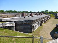
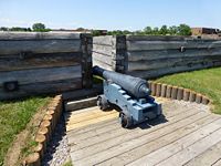
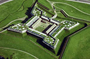
French & Indian War (1754-1763) Fort Stanwix was sited to protect the strategic one mile portage between the Mohawk River and Wood Creek called the "Oneida Carrying Place". Construction began 26 Aug 1758 and was not completed until about 1762. The fort was large and expensive for the day. The perimeter measured 1,450 feet and included four bastions, one at each corner. The walls were 17 feet high built of 2 foot squared logs. A forty foot wide by fourteen foot deep dry moat surrounded the walls. The cost has been estimated to be $266,000, a very large sum for the day. The fort fell into disrepair after the British conquered Canada in 1760.
Revolutionary War (1775–1783) The fort was occupied by American forces in 1776, rebuilt and renamed Fort Schuyler (2). In 1777 British forces under General Barry St. Leger besieged the fort and were repulsed. The fort remained garrisoned until it burned to the ground in 1781. It was substantially rebuilt and the name changed back to the original Fort Stanwix. In 1784 the treaty of Fort Stanwix was negotiated with the Iroquois Confederation. The Iroquois ceded a large portion of their lands to the American Government.
War of 1812 (1812-1814)By the start of the War of 1812 the fort had been seriously neglected and an emergency blockhouse was erected on the parade. Starting in 1828 the fort was dismantled. Current StatusMust See! Part of Fort Stanwix National Monument, reconstructed to its 1777 appearance.
Sources:
Links:
Visited: 30 Jul 2012
| ||||||


