Fort Ward (2)
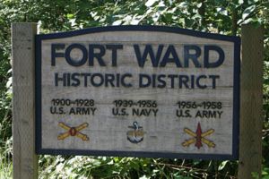
Fort Ward (2) (1901 - 1938, 1942 - 1958) - Construction began 1 Feb 1900, completed in 1901, named Fort Ward in G.O. 84, 12 Jun 1903, after Col. George H. Ward, 15th Massachusetts Volunteer Infantry, Bvt. Brigadier General, U. S. Volunteers, who died , 2 Jul 1863, of wounds received at the battle of Gettysburg, Pennsylvania, during the U.S. Civil War. Abandoned as coastal defense in 1928 and turned over to U.S. Navy in 1938. Decommissioned by the Navy in 1958.


Fort Ward (2) History
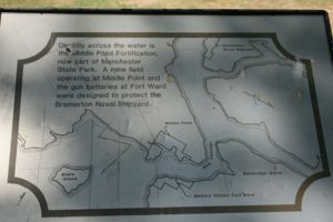
Commissioned as Endicott Period seacoast fort to protect the Bremerton Navy Yard and the Rich Passage. Construction on the five concrete gun batteries was begun in 1899 and was complete in 1903. The gun batteries were all accepted for service on 18 Jan 1904 although some of them were not yet armed. Placed in caretaker status 26 Jun 1924. Abandoned as a Coastal Artillery Station and withdrawn from the Puget Sound Harbor Defense 1 Mar 1928.
| Battery Click on Battery links below |
No. | Caliber | Type Mount | Service Years | Battery Cost | Notes |
|---|---|---|---|---|---|---|
| Battery Nash | 3 | 8" | Disappearing | 1899-1903-1904-1917 | $ 120,432 | On Private Property |
| Battery Warner | 2 | 5" | Pedestal | 1900-1903-1904-1925 | $ 24,935 | On Private Property |
| Battery Thornburgh | 4 | 3" | Masking Pedestal | 1900-1903-1904-1920 | $ 21,885 | |
| Battery Vinton | 2 | 3" | Masking Pedestal | 1900-1903-1904-1920 | $ 10,967 | Lower rooms filled in |
| Battery Mitchell (1) | 2 | 3" | Pedestal | 1900-1903-1904-NA | $ 9,473 | On Middle Point MR. Never armed |
| Source: CDSG | ||||||

World War II
During World War II the U.S. Navy established a top-secret radio listening post on Fort Ward to eavesdrop on enemy communications in the far east. Antennas were installed on the post and existing buildings were converted into a top-secret listening post code-named "Station S". "Station S" listened in on Japanese naval Morse Code communications 24 hours a day.
Current Status
Washington State Park. No period guns or mounts in place.
|
{"selectable":false,"width":"500"} |
Location: Bainbridge Island, Washington Maps & Images Lat: 47.58417 Long: -122.52694 |
Sources:
- Roberts, Robert B., Encyclopedia of Historic Forts: The Military, Pioneer, and Trading Posts of the United States, Macmillan, New York, 1988, 10th printing, ISBN 0-02-926880-X, page 838
- North American Forts
- Coastal Defense Study Group
- Wikipedia
Links:
Visited: No
Fort Ward (2) Picture Gallery
|
Click on the picture to see a larger version. Contribute additional pictures - the more the better! |