Naselle Air Force Station
|
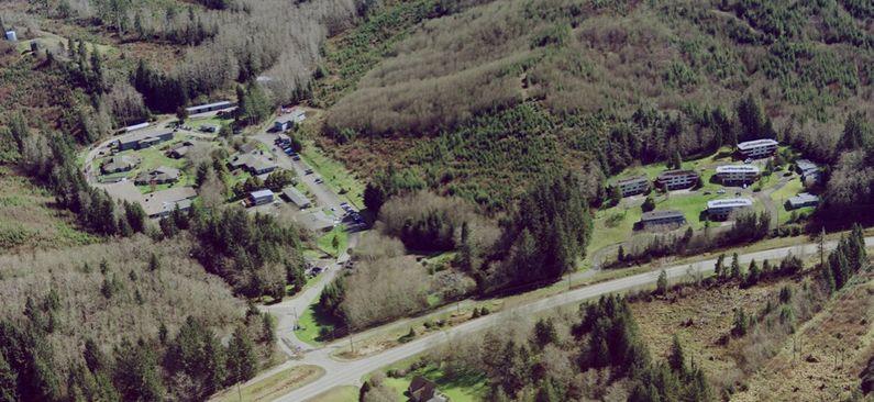
Naselle Air Force Station (1950-1966) - A Cold War Air Force Radar Station first established in 1950 near Naselle, Pacific County, Washington. Named Naselle Air Force Station after the location. Initially assigned a Permanent ID of P-57, later a Sage ID of Z-57. Abandoned in 1966. HistoryEstablished in 1950 and became operational in December 1951 as Naselle Air Force Station manned by the 759th AC&W Squadron. Replaced two Lashup Radar sites, L-35 at Pacific Beach, Washington, and L-36 at Fort Stevens, Oregon. The two lashup sites were discontinued in February 1952. The station initially had both a Ground-Control Intercept (GCI) and early warning mission. The early warning mission involved tracking and identifying all aircraft entering their airspace while the GCI mission involved guiding Air Force interceptors to any identified enemy aircraft. Controllers at the station vectored fighter aircraft at the correct course and speed to intercept enemy aircraft using voice commands via ground-to-air radio. Initial equipment included FPS-3 search radar and FPS-5 height-finder radar. In 1958 the FPS-3 search radar was upgraded to the FPS-20 and two height-finder radars, one FPS-6 and one FPS-6A were installed in preparation for integration into the SAGE System. An FPS-26A height-finder later replaced one of the FPS-6 height-finders. SAGE System TransitionThe transition of the manual GCI system to the automated SAGE system began with the installation of the FST-2 coordinate data transmitter and search radar upgrades. The FST-2 equipment digitized the radar returns and transmitted the digital returns to the SAGE direction center. Under the SAGE System, interceptor aircraft were directed to their targets by the direction center computers and controllers, greatly reducing the need for local controllers and equipment at every radar station. The FST-2 was a very large digital system using vacuum tube technology. Over 6900 vacuum tubes were used in each FST-2 requiring 21 air-conditioned cabinets, 40 tons of air conditioning, 43.5 kva of prime power, and usually a large new addition to the operations building. The FST-2B modification added two more cabinets but with newer solid-state (transistor) technology to process coded responses from aircraft transponders. SAGE System OperationThe site began operation as a SAGE site in February 1960 initially feeding radar data to the McChord SAGE Direction Center DC-12. ClosureSAGE operation continued until the site and the 759th Radar Squadron were deactivated on 1 Apr 1966 in the first round of SAGE consolidations and reorganizations. Physical Plant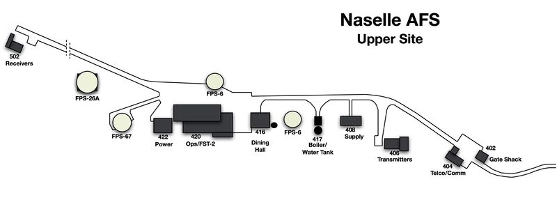 The physical plant of the site was divided into the main site, a cantonment area, a housing area, and a radio site. The main site was located separately from the other sites on "Radar Ridge" and it housed the operations buildings, the radar towers, a dining hall, and backup generators. Also on the upper site were separate Ground to Air Transmitter/Receiver (GATR) radio sites that housed the equipment for directing aircraft intercepts. The lower cantonment area housed the enlisted barracks, the bachelor officer's quarters, the orderly room, the dining hall, the motor pool, and other support buildings. Apart from the main site was a small housing area for critical married personnel.
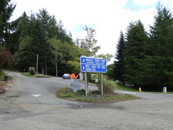
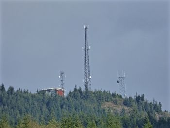
Current Status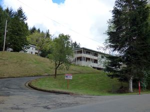 The lower site is now Naselle Youth Camp established after the site closed in 1966 while the upper site now has commercial radio facilities. The family housing area appears to now be dorms for the Naselle Youth Camp with just a few houses remaining. The road leading to the upper site is open to the public, the youth camp facilities are not.
See Also:
Sources:
Fortification ID:
Visited: 17 Sep 2015
| ||||||||||||||||||||||||||||||||||||||||||||||||||||||||||||||||||||||||||||||||||||||||||||||||||||||||||||||||||||||||||||||||||||||||||||||||||||||||||||||||||||||||||||||||||||||||||||||||||||||||||||||||||||||||||||
