Omaha Air Force Station
|
Omaha Air Force Station (1951-1968) - A Cold War U.S. Air Force Radar Station established during the Korean War. Located near Omaha in Douglas County, Nebraska. Initially assigned a Permanent ID of P-71, a Sage ID of Z-71 and an FAA ID of QHO. The Air Force Station closed in 1968 and the FAA Radar Site continues in operation as of 2020. HistoryEstablished on 1 May 1951 and became operational in April 1952 as Omaha Air Force Station manned by the 789th Aircraft Control & Warning (AC&W) Squadron. Initial equipment included the FPS-3 search radar and a CPS-4 height-finder radar. The CPS-4 height-finder radar was replaced with a FPS-6 and the FPS-3 was replaced with a FPS-20. This configuration (a SAGE qualified long-range search radar and two SAGE qualified height-finders) met the requirements for transition to SAGE System operation. SAGE System TransitionThe transition of the manual GCI system to the automated SAGE system began with the installation of the FST-2 coordinate data transmitter and search radar upgrades. The FST-2 equipment digitized the radar returns and transmitted the digital returns to the SAGE direction center. Under the SAGE System, interceptor aircraft were directed to their targets by the direction center computers and controllers, greatly reducing the need for local controllers and equipment at every radar station. The FST-2 was a very large digital system using vacuum tube technology. Over 6900 vacuum tubes were used in each FST-2 requiring 21 air-conditioned cabinets, 40 tons of air conditioning, 43.5 kva of prime power, and usually a large new addition to the operations building. The FST-2B modification added two more cabinets but with newer solid-state (transistor) technology to process coded responses from aircraft transponders. SAGE System Operation
In late 1959 Omaha AFS was also performing air traffic control duties. The site began operation as a SAGE site in 1961 initially feeding the Sioux City SAGE Direction Center DC-22. On 1 Jan 1962, the squadron designation was changed from the 789th AC&W Squadron to 789th Radar Squadron (SAGE) indicating the new SAGE System role. On 31 Jul 1963, the site was redesignated as NORAD ID Z-71. A second height-finder radar, an FPS-6A was installed in 1962. The FPS-20A radar was upgraded to become an FPS-66 in 1964 and again in 1967 to an FPS-66A configuration. Omaha NIKE Army Air-Defense Command Post (AADCP)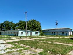 A U.S. Army Air-Defense Command Post (AADCP) and Headquarters were established at Omaha AFS in 1961 for Nike-Hercules missile command-and-control functions as part of the defense of nearby Offutt AFB and Lincoln AFB. The command post was operated by the U.S. Army 6th Missile Battalion, 43rd Artillery with four firing batteries, two for the Offutt Defense Area, and two for the Lincoln Defense Area. The U.S. Army Command Post and the four firing batteries were connected by the GSG-5 BIRDIE solid-state computer system. The colocated command post at Omaha AFS allowed the GSG-5 to accept SAGE generated targets and/or use local shared Radar video to generate targets directly in the GSG-5. Under SAGE control, the targets for the Nike-Hercules missiles would be assigned by the Sioux City SAGE Direction Center DC-22. If the SAGE System became inoperative, the shared local radar video could be used to directly assign targets in the GSG-5 BIRDIE system. Closure of the Command Post and the four firing batteries was announced in December 1965 with an expected closure by 1 Jul 1966, by that date the sites had been deactivated.
Gap FillersOmaha AFS was responsible for the maintenance of one remote unattended gap-filler radar site. The unattended gap filler sites were placed in locations where the main search radar lacked coverage. These sites were equipped with short range FPS-14 or FPS-18 search radars and FST-1 Coordinate Data transmitters that sent digitized radar target data to a SAGE direction center and to the main radar site. Both the radar set and the FST-1 were dual channel to increase site up time. Maintenance teams were dispatched for regularly scheduled maintenance or when fault indicators on the FSW-1 remote monitoring equipment suggested the site had problems. The FSW-1 also allowed remote operation of specific functions such as channel changes for the radar and for the FST-1, it also allowed remote operation of the diesel generators at the gap filler site. The Omaha AFS gap-filler radar was located at Dallas Center, IA. Three other gap-filler sites were planned but not built.
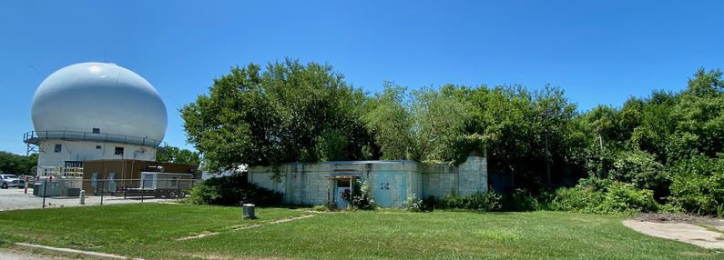
Air Force Station ClosureOmaha AFS and the 789th Radar Squadron were deactivated on 8 Sep 1968. Omaha FAA Radar Site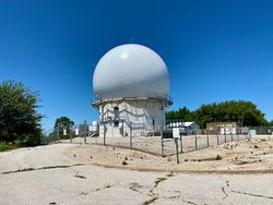 The FAA assumed operational responsibility for the FPS-66A search radar prior to the deactivation of Omaha AFS. On deactivation, the FAA retained control of a small area surrounding the FPS-66A search tower and that area continues to house an FAA Search Radar now updated to a CARSR configuration. A FYQ-47 Common Digitizer was probably placed in service by February 1973 when the USAF/FAA FST-2 to FYQ-47 replacement program was completed. By 1990 the site was equipped with an FPS-66A search radar and a CD-2A Common Digitizer. The Omaha CD-2A was scheduled to receive an upgrade kit to implement three level weather data processing in March 1992. CARSR RadarThe nationwide replacement program converting FAA legacy radar systems to the CARSR radar configuration was completed by 17 Aug 2015 and Omaha FAA Radar Site was a part of that program. Legacy FAA radars underwent a Service Life Extension Program (SLEP) that replaced key components in the vintage ARSR-1, ARSR-2, FPS-20, FPS-66 and FPS-67 radars. The CARSR program replaced legacy klystron radar transmitters with a solid-state transmitter as well as renovating the radar receiver and signal processor. The CARSR modification also included common digitizer functionality making a separate common digitizer unnecessary. The Omaha FAA Radar Site is now operating with the CARSR radar. At the time of the CARSR changeout, the legacy radar in place was an FPS-66A and the CARSR conversion included a 1561 antenna. The secondary radar for the site in 2015 was the ATCBI-6 Beacon set. The radar site data is now available to the USAF/NORAD Battle Control System-Fixed (BCS-F) operations centers (EADS & WADS) as well as the FAA Minneapolis ARTCC (ZMP) and adjacent ARTCCs. Other federal agencies have access to the data under the Homeland Security umbrella. USAF Physical Plant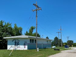 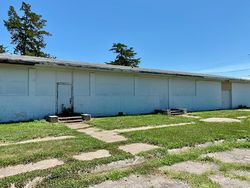 The physical plant of the Air Force Station was divided into the main site, a cantonment area, a housing area, and a radio site. The main site housed the operations buildings, the radar towers, and the backup generators. The cantonment area housed the enlisted barracks, the bachelor officer's quarters, the orderly room, the dining hall, the motor pool, and other support buildings. Apart from the main site was a small 9 unit housing area for married personnel. A separate radio site housed the radio equipment for directing aircraft intercepts. Like most early radar stations, Omaha originally had a radio transmitter site and a separate radio receiver site used by local controllers for voice direction of fighter interceptors to their targets. With the SAGE System, the SAGE Direction centers had the primary task of directing intercepts and the local radio sites were reconfigured, usually into a single site that was known as the Ground to Air Transmitter Receiver (GATR) site. The GATR site communicated with the interceptors from either the local site or the SAGE direction center via voice commands and/or a digital data link. The contract award for the construction of the Omaha AFS GATR site was announced in December 1960 to the Anderson Construction Company for $83,000. The GATR site was located about 2.75 air miles west of the main site. 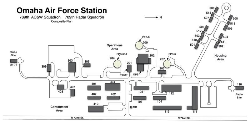
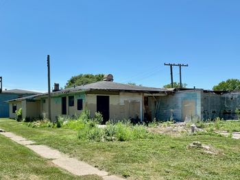
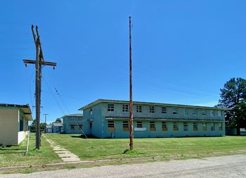
Current StatusNow the site of the Omaha FAA Radar Site which occupies part of the old air force station operations area surrounding the search radar tower. The GSA conveyed 1.10 acres and the radar tower building to the FAA on 14 Aug 1969, including the electrical power station and diesel storage facility. The remaining land parcels including buildings were conveyed to public and private entities. Many of the original buildings remain, some in advanced disrepair.
See Also: Sources:
Links: Visited: 27 Jul 2020
|
