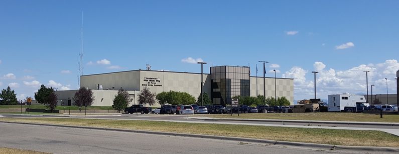
RCAF Station Alsask
|
RCAF Station Alsask (1963-1986) - A Cold War Canadian Pinetree Line Radar Station constructed in 1961-1962 near Alsask, Saskatchewan. Officially established on 1 Nov 1962 and declared SAGE Operational in May 1963 connected to Malmstrom SAGE Direction Center DC-20 at Malmstrom Air Force Base, Great Falls, Montana. Initially assigned a Permanent ID of C-53 and a Sage ID of C-53. Renamed CFS Alsask in May 1967 as a result of Canadian military forces unification. Closed on 1 Aug 1987. HistoryEstablished on 1 Nov 1962 and became operational in May 1963 as RCAF Station Alsask manned by the 44 Aircraft Control & Warning (AC&W) Squadron. Initial equipment included the FPS-7C search radar, one FPS-507 height-finder, and one FPS-26 height-finder radar. The automated SAGE system included the installation of the FST-2 coordinate data transmitter. The FST-2 equipment digitized the radar returns and transmitted the digital returns to the SAGE direction center. Under the SAGE System, interceptor aircraft were directed to their targets by the direction center computers and controllers, greatly reducing the need for local controllers and equipment at every radar station. The FST-2 was a very large digital system using vacuum tube technology. Over 6900 vacuum tubes were used in each FST-2 requiring 21 air-conditioned cabinets, 40 tons of air conditioning, 43.5 Kva of prime power, and usually a large new addition to the operations building. The FST-2B modification added two more cabinets but with newer solid-state (transistor) technology to process coded responses from aircraft transponders. SAGE System Operation
The site began operation as a SAGE site in May 1963. initially feeding the Malmstrom SAGE Direction Center DC-20. The squadron designation was changed from the 44 AC&W Squadron to the 44 Radar Squadron indicating the new SAGE System role. The original FPS-7C radar was due for an upgrade by the late 1960s. Modifications were designed to simplify the radar and make it more maintainable. The stacked beam capability was removed along with associated receivers and transmitter hardware. The power supply, the transmitter oscillator/driver, and the waveguide pressurization systems were updated. The modified FPS-7C was re-designated an FPS-107 and brought back online on 25 Apr 1972. That same year the massive vacuum-tube FST-2 was replaced with the much smaller, more reliable, and efficient solid-state FYQ-47 Common Digitizer and the GPA-124 Mark XII IFF/SIF crypto-secure system. The new digitizer was operational on 13 Jul 1972. On 1 Apr 1975, the FPS-26 Height Finder was turned off reflecting the increase in aircraft reporting their own altitude via the IFF/SIF equipment. These changes in the 1970s greatly reduced maintenance and logistics requirements enabling significant personnel and support reductions. On 1 Mar 1983 the Malmstrom SAGE Direction Center DC-20 shut down as a result of the deactivation of the SAGE System. The replacement for SAGE was to be the Regional Operations Control Center (ROCC) system and in the US the new ROCCs were ready to go when SAGE was turned off. In Canada, it was a different story, the ROCCs (East and West) were to be placed in the same underground facility that had housed the SAGE Direction Center so there was a transition period. It is unclear where CFS Alsask was connected during the transition period but it was probably the McChord Regional Operations Control Center at McChord AFB, Washington. In August 1984, both ROCCs Canada East and Canada West (Alsask came under Canada West) were declared operational. Under the SAGE System, Canada was never able to connect all their radar sites to their single Direction Center but under the ROCC system, they had the ability to do so. ClosureRCAF Station Alsask and the 44 Radar Squadron were deactivated on 1 Aug 1987.
Physical PlantThe physical plant of the site was divided into the main site, a cantonment area, a housing area, and a radio site. The main site housed the operations buildings, the radar towers, and the backup generators. The cantonment area housed the enlisted barracks, the bachelor officer's quarters, the orderly room, the dining hall, the motor pool, and other support buildings. Apart from the main site was a housing area for married personnel. Initially, 90 double-wide trailers were installed and ready for occupancy as PMQs by the autumn of 1963. A separate radio site housed the radio equipment for directing aircraft intercepts. With the SAGE System, the SAGE Direction centers had the primary task of directing intercepts and the local radio site was configured into a single site that was known as the Ground to Air Transmitter Receiver (GATR) site. The GATR site communicated with the interceptors from either the local site or the SAGE direction center via voice commands and/or a digital data link.
Current StatusAlsask OPS site was taken over by the Canadian Civil Defence Museum Association/Archives(CCDMA) on 1 Jun 2018. The CCDMA is restoring the tower to its original state and finally, after all these years are allowing tours for the general public.
See Also:
Sources:
Links:
Visited: No
|
