Sundance Air Force Station
|
Sundance Air Force Station (1962-1968) - A Cold War Air Force Radar Station established in 1960 on Warren Peak near Sundance, Crook County, Wyoming. Named Sundance Air Force Station after the nearby town of Sundance. The main site was powered by a portable nuclear power plant. The site was initially assigned a Permanent ID of TM-201, later a Sage ID of Z-201. The operation was discontinued in 1968.
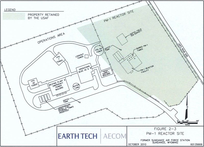
History Established in 1960 as Sundance Air Force Station manned by the 731st Radar Squadron (SAGE). The Air Force Station was located on four different sites along Warren Peak Road (Hwy 208) near the City of Sundance, Wyoming. The main site was located on Warren Peak itself while the housing area and the cantonment area were located at the base of the peak. The radio site was located beyond the main site still on Warren Peak Road. Initial radar equipment included the FPS-7C search radar and FPS-6 and FPS-26 height-finder radars. Primary electrical power on the main site was provided by an experimental one-of-a-kind PM-1 transportable nuclear power plant which also provided steam heat for the main site. The PM-1 reactor installation began in June 1961 and the power plant was dedicated on 18 Sep 1962. The site and the unit initially came under the command of the 29th Air Division at Malmstrom Air Force Base and the Malmstrom Manual Direction Center P-83 but the site was not yet operational. The additional testing required for the power plant contributed to a delayed operational date.  SAGE System TransitionThe transition of the site into the automated SAGE system began with the installation of the FST-2 coordinate data transmitter and search radar upgrades. The FST-2 equipment digitized the radar returns and transmitted the digital returns to the SAGE direction center. Under the SAGE System, interceptor aircraft were directed to their targets by the direction center computers and controllers, greatly reducing the need for local controllers and equipment at every radar station. The FST-2 was a very large digital system using vacuum tube technology. Over 6900 vacuum tubes were used in each FST-2 requiring 21 air-conditioned cabinets, 40 tons of air conditioning, 43.5 kva of prime power, and usually a large new addition to the operations building. The FST-2B modification added two more cabinets but with newer solid-state (transistor) technology to process coded responses from aircraft transponders. SAGE System Operation
The site began operation as a SAGE System site on 1 Nov 1962 initially feeding data to the Minot SAGE Direction Center DC-19. With the deactivation of the Minot SAGE Direction Center in 1963, Sundance AFS began feeding data to the Sioux City SAGE Direction Center DC-22. ClosureThe Sioux City SAGE Direction Center DC-22, Sundance AFS, and the 731st Radar Squadron (SAGE) were all deactivated on 18 Jul 1968. The closure of the site took some time, not only to remove the radar and radio equipment but because of the required decontamination and precautions taken with the nuclear reactor. Physical PlantThe physical plant of the site was divided into the main site, a cantonment area, a housing area, and a radio site.
  The main site housed the operations buildings, the radar towers, backup generators, and uniquely, a nuclear power plant. The PM-1 transportable nuclear power plant was installed at Sundance as a test of the feasibility of powering remote radar sites with nuclear power. The PM-1 generated 1,000 KW of high-quality electrical power and 7,000,000 Btu's per hour of steam used to heat the buildings. Testing delayed the operational date of the site until 1962 and necessitated a special team of reactor operators in a 24-7 operation.
  A separate Ground to Air Transmitter/Receiver (GATR) radio site north of the main site housed the radio equipment for directing aircraft intercepts. The cantonment area housed the enlisted barracks, the bachelor officer's quarters, the orderly room, the dining hall, the motor pool, and other support buildings. Just south of the cantonment area was a small 27 unit housing area for critical married personnel. The Cantonment Area and the Housing Area were directly adjacent. The housing area originally had just 9 units that were constructed on-site as a part of the original site plan. In 1963, 18 additional units were built on-site from prefabricated packages designed to be relocatable should mission needs change.
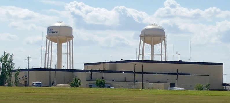
Current StatusThe main site has been repurposed with communications facilities and fenced off. The cantonment area and the housing area are under private ownership.
See Also:
Sources:
Visited: 5 Jun 2020
| ||||||||||||||||||||||||||||||||||||||||||||||||||||||||||||||


